National Weather Service Storm Prediction Center Severe Weather Outlook for Florida on Thursday, May 7, 2026.
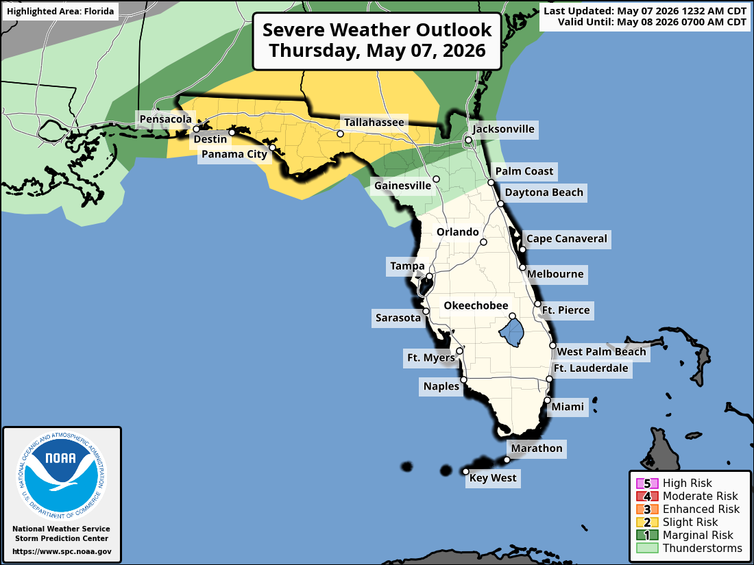
JACKSONVILLE, Florida – The National Weather Service Storm Prediction Center has placed portions of southeast Georgia and the Suwannee Valley in northeast Florida under a Slight Risk (level 2/5) for severe thunderstorms on Thursday, May 7, 2026.
Strong to isolated severe thunderstorms are expected across southeast Georgia and along the Interstate 10 corridor in northeast Florida, mainly during the afternoon and early evening hours through this evening.
The National Weather Service in Jacksonville is alerting residents of the severe storm risk today, particularly north of I-10. The primary threat is damaging wind gusts of 40-60 mph.
According to NWS Jacksonville, stronger storms may develop with the Slight (2/5) risk level, with scattered strong-to-severe thunderstorms possible across northeast Florida and southeast Georgia.
Stronger storms on Thursday may produce:
A Red Flag Warning is also in effect for parts of northeast Florida due to breezy conditions, low humidity, and ongoing exceptional drought, increasing wildfire danger. Practice wildfire prevention measures, especially under burn bans or water restrictions. The storms are expected to bring widespread beneficial rainfall providing needed moisture amid the drought.
North Florida areas at highest risk for thunderstorms include:
Thursday
Hot with a high near 95°F. Breezy south winds 10-15 mph with higher gusts possible. Strong to isolated severe thunderstorms likely in the afternoon and evening, especially north of I-10. Chance of precipitation 70-90%. Hazards include damaging winds, frequent lightning, locally heavy downpours, and low risk of tornadoes.
Thursday Night
Chance of showers and thunderstorms, mainly before midnight. Low around 70°F. South wind 5-10 mph.
The NWS Jacksonville forecast indicates widespread beneficial rainfall is expected with these storms, providing needed moisture amid ongoing drought conditions, while the primary concerns remain damaging winds and possible isolated tornadoes on Thursday.
Copyright 2023-2025 FloridaWord.com


