National Weather Service Storm Prediction Center Severe Weather Outlook for Florida on Saturday, May 2, 2026.
TALLAHASSEE, Florida – Widespread rain and thunderstorms are impacting north Florida, southeast Alabama’s Wiregrass region, and southwest Georgia this Saturday morning, according to the National Weather Service in Tallahassee.
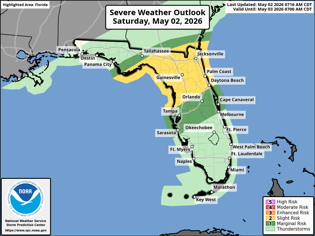
The Storm Prediction Center has placed the Florida Big Bend and adjacent portions of southwest Georgia under a Slight Risk (Level 2 of 5) of severe thunderstorms today through early afternoon.
The severe weather threat is conditional and heavily dependent on the position of a warm front lifting northward. If the warm front surges farther north, the severe threat will spread more inland across the Big Bend and southwest Georgia. If it remains farther south or offshore, the strongest storms will stay more coastal.
According to the National Weather Service Tallahassee, isolated strong to severe storms are possible today, especially across the FL Big Bend and adjacent southwest Georgia.
Primary hazards with any stronger storms include damaging wind gusts up to 60 mph, hail up to one inch in diameter, and a low chance of an isolated tornado. Lightning remains a concern with all thunderstorms.
On a positive note, widespread beneficial rainfall is occurring region-wide and will continue through Sunday night, with Saturday expected to be one of the rainiest days. This will help alleviate ongoing dry conditions across the area.
Cities at risk for thunderstorms and possible strong to severe weather today include:
High temperatures across the Florida Panhandle and north Florida will be much cooler than normal today due to the persistent rain and clouds, generally in the upper 60s to low 70s°F. Overnight lows will drop into the upper 50s to low 60s.
Copyright 2023-2025 FloridaWord.com


