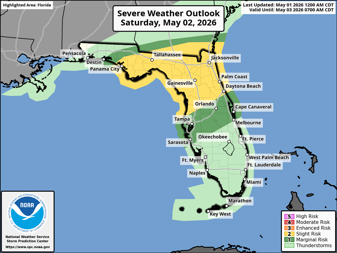
National Weather Service Storm Prediction Center Severe Weather Outlook for Florida on Saturday, May 2, 2026.
TALLAHASSEE, Florida – The National Weather Service Storm Prediction Center has forecast a Marginal Risk (Level 1 of 5) of strong to severe thunderstorms across the Florida Panhandle and adjacent southeast Alabama’s Wiregrass region and southwest Georgia for Friday night into early Saturday.
A Slight Risk (Level 2 of 5) is forecast for Saturday across the entire Florida Big Bend, parts of the Panhandle, and portions of southwest Georgia.
According to the National Weather Service Tallahassee, isolated strong to severe storms are possible Friday night into Saturday. The most at-risk areas tonight include locations along and north of the I-10 corridor in the Florida Panhandle and adjacent southeast Alabama and southwest Georgia. .
On Saturday, the severe potential is heavily dependent on the position of a warm front—greater inland if the front stays north, more coastal if it shifts south.
The primary hazards with any stronger storms include isolated damaging wind gusts up to 60 mph and hail up to one inch in diameter. A tornado or two is possible. Lightning is a concern across the region as thunderstorms develop.
On a positive note, widespread beneficial rainfall is forecast region-wide from tonight through Sunday night, with Saturday expected to be the rainiest day. This will help alleviate ongoing dry conditions.
Cities at risk for thunderstorms and possible strong to severe weather include:
High temperatures across the Florida Panhandle and north Florida will be in the upper 80s to low 90s today with lows in the upper 60s overnight.
Copyright 2023-2025 FloridaWord.com


