National Weather Service Storm Prediction Center Severe Weather Outlook for Florida on Saturday, May 2, 2026.
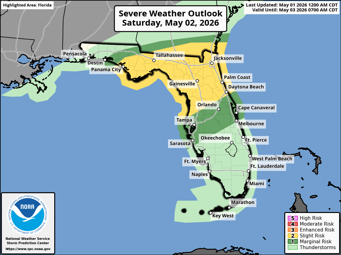
ORLANDO, Florida – The National Weather Service Storm Prediction Center has issued a Severe Weather Outlook for Saturday, May 2, 2026, with a Slight Risk of severe thunderstorms across portions of east central Florida (particularly northern Lake and Volusia counties) and a Marginal Risk farther south.
Mostly dry and hot conditions are expected today (Friday, May 1) across East Central Florida, with highs in the upper 80s to low/mid 90s. Isolated showers are possible near Daytona Beach and Astor.
Hot and windy conditions are forecast for Saturday with near-record highs in the low to mid 90s. Scattered showers and thunderstorms are expected to develop in the afternoon across portions of the Florida Peninsula and become more numerous in the evening. A few storms may become strong to severe.
The NWS warns of the following hazards during the peak storm hours on Saturday:
According to the National Weather Service in Melbourne, a High risk of rip currents is in effect today for all central Florida Atlantic beaches from Daytona Beach southward. Strong, life-threatening currents are possible.
East Central Florida cities forecast to see very warm temperatures today include:
Today (Friday)
Mostly dry and hot. High near 93°F. Chance of precipitation near 0%. South wind around 10 mph.
Tonight
Partly cloudy. Low around 68°F.
Copyright 2023-2025 FloridaWord.com


