National Weather Service Storm Prediction Center Severe Weather Outlook for Florida on Monday, May 11, 2026.
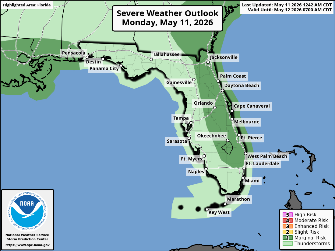
JACKSONVILLE, Florida – The National Weather Service in Jacksonville is forecasting isolated strong to severe thunderstorms late this afternoon into tonight across northeast Florida and southeast Georgia, driven by the Atlantic sea breeze pushing inland and interacting ahead of an approaching cold front.
Isolated strong to severe thunderstorms are expected mainly late this afternoon through the evening (roughly 4:30 PM to 11:30 PM), with the best chances along the I-95 and I-10 corridors.
The National Weather Service in Jacksonville is alerting residents of the storm risk today. High temperatures will reach the upper 80s to low 90s°F with muggy conditions. The primary threat is damaging wind gusts of 40-60 mph.
According to NWS Jacksonville, stronger storms may develop with isolated strong to severe thunderstorms possible as the sea breeze merges and interacts with the approaching cold front.
Stronger storms on Monday may produce:
Isolated storms will continue overnight, but strong or severe impacts are not expected. Ongoing extreme to exceptional drought conditions continue across the region. The storms are expected to bring widespread beneficial rainfall, providing needed moisture amid the drought. Residents should practice wildfire prevention measures given the dry conditions and ongoing fire activity.
Northeast Florida areas at highest risk for thunderstorms include:
Monday
An approaching cold front will bring a chance of showers and thunderstorms, then showers and possibly a thunderstorm after 3pm. Patchy fog before 7am. High near 86. Calm wind becoming southwest 5 to 8 mph in the afternoon. Chance of precipitation is 80%. New rainfall amounts between a tenth and quarter of an inch, except higher amounts possible in thunderstorms. Hazards include damaging winds (40-60 mph), frequent lightning, locally heavy downpours, small hail, and a small chance of a brief tornado.
Monday Night
Showers and possibly a thunderstorm before 11pm, then showers likely. Low around 68. South wind around 5 mph becoming calm in the evening. Chance of precipitation is 80%.
Copyright 2023-2025 FloridaWord.com


