National Weather Service Storm Prediction Center Severe Weather Outlook for Florida on Thursday, May 7, 2026.
TALLAHASSEE, Florida – Rain and thunderstorms are expected to impact north Florida, southeast Alabama’s Wiregrass region, and southwest Georgia this Thursday, according to the National Weather Service in Tallahassee.
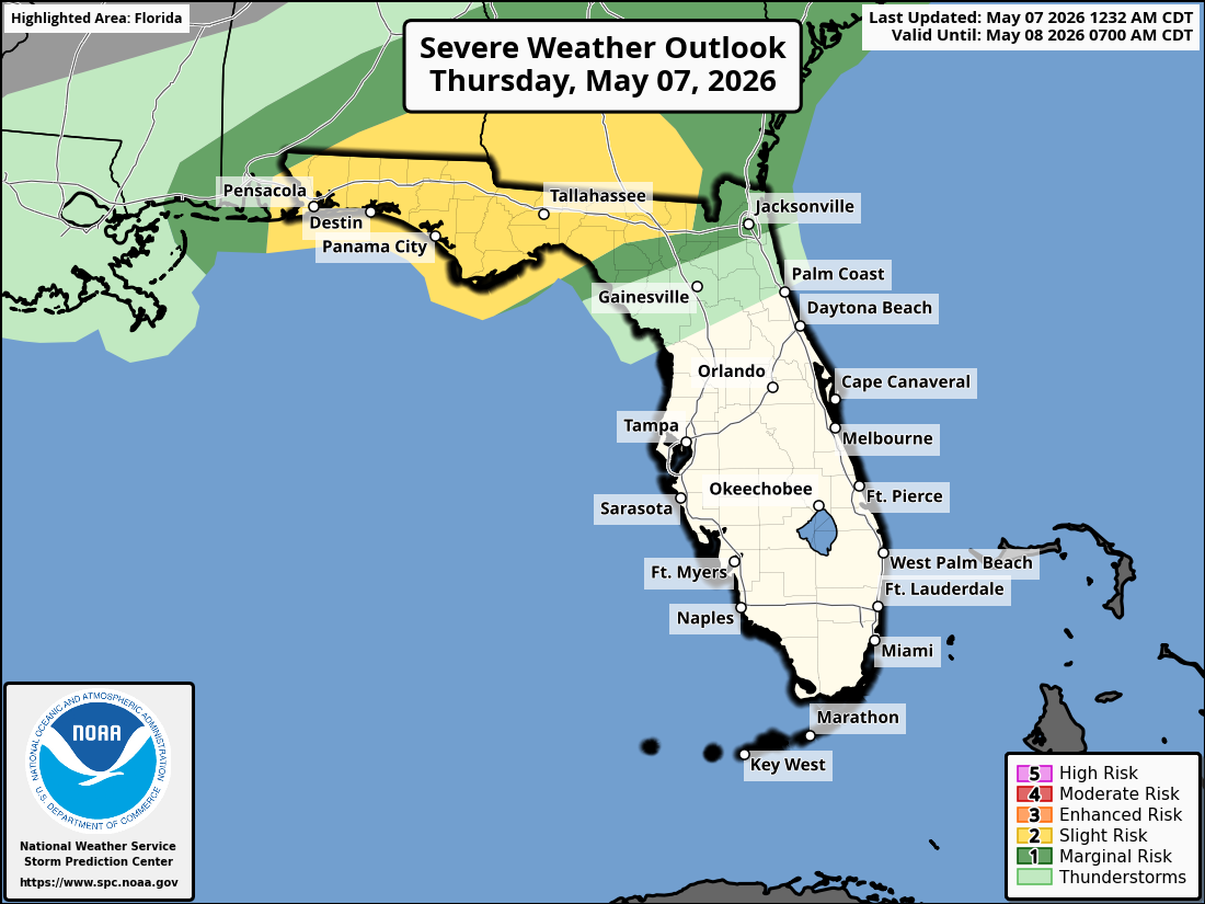
The Storm Prediction Center has placed southeast Alabama, southwest Georgia, the Florida Panhandle, and the Florida Big Bend under a Slight Risk (Level 2 of 5) of severe thunderstorms today. A Tornado Watch is in effect until 10 AM EDT.
Scattered strong to severe storms are possible early this morning through the afternoon, especially across the FL Big Bend, Panhandle, and adjacent portions of southwest Georgia and southeast Alabama. Storms will weaken as they move southeast.
Primary hazards with any stronger storms include damaging wind gusts of 40-60 mph, large hail, and a tornado or two. Lightning remains a concern with all thunderstorms.
On a positive note, beneficial rainfall is expected region-wide and will continue through the weekend. This will help alleviate ongoing dry conditions across the area.
Cities at risk for thunderstorms and possible strong to severe weather today include:
High temperatures across the Florida Panhandle and north Florida will be in the upper 80s °F. Overnight lows will drop into the upper 60s.
Copyright 2023-2025 FloridaWord.com


