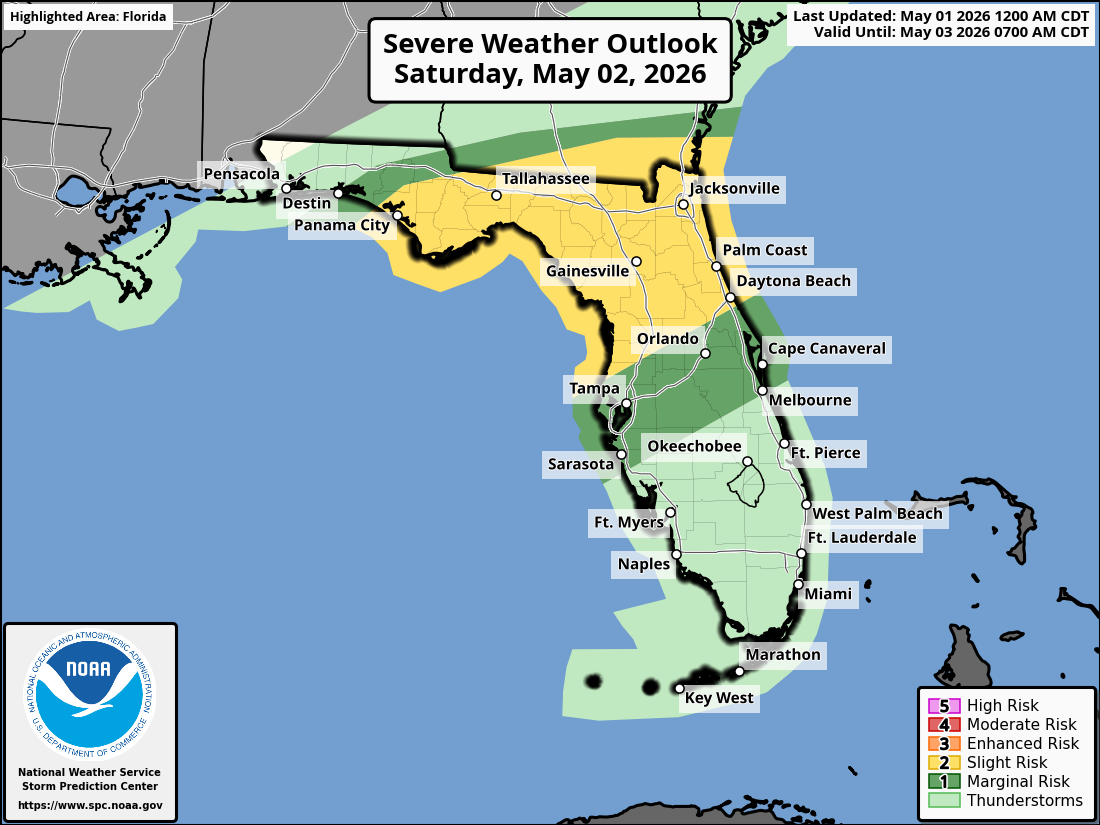
National Weather Service Storm Prediction Center Severe Weather Outlook for Florida on Saturday, May 2, 2026.
JACKSONVILLE, Florida – The National Weather Service Storm Prediction Center has upgraded areas south of Waycross to a Slight Risk (level 2/5) for severe thunderstorms on Saturday, May 2, 2026, for North Florida and southeast Georgia.
A squall line containing strong to severe thunderstorms is expected to cross the area from west to east on Saturday, mainly impacting southeast Georgia during the morning and northeast Florida during the afternoon and evening.
According to NWS Jacksonville, stronger storms may develop under the Slight (2/5) risk level south of Waycross, with scattered strong-to-severe thunderstorms possible across northeast Florida and southeast Georgia.
Stronger storms on Saturday may produce:
Additionally, increased wildfire danger is expected due to ongoing exceptional and extreme drought conditions affecting the region. Practice wildfire prevention measures, especially under burn bans or water restrictions.
North Florida and southeast Georgia areas at risk for thunderstorms include:
Saturday
Showers and thunderstorms likely, with scattered severe thunderstorms possible in the afternoon and evening. High near 83°F. Breezy, with a south wind 6 to 16 mph, with gusts as high as 25 mph. Chance of precipitation is 90%. Hazards include damaging winds, frequent lightning, locally heavy downpours, small hail, and a low risk of tornadoes.
Saturday Night
Showers and thunderstorms likely before 11pm, then a chance of showers. Low around 56°F. South wind 6 to 16 mph. Chance of precipitation is 80%.
The NWS Jacksonville forecast indicates widespread beneficial rainfall is expected with these storms, providing needed moisture amid ongoing drought conditions, while the primary concerns remain damaging winds and possible isolated tornadoes on Saturday.
Copyright 2023-2025 FloridaWord.com


