National Weather Service Miami South Florida Rain Chances Sunday, May 17, 2026.
MIAMI, Florida – The National Weather Service Storm Prediction Center (SPC) has issued a Marginal Risk (Level 1) of severe thunderstorms for portions of South Florida on Sunday, May 17, 2026.
The risk area primarily covers southwest Florida, mainly closer to the Gulf coast where the Gulf breeze is pinned near the coast due to strong low-level easterly flow.
The National Weather Service in Miami is monitoring the Marginal Risk of severe thunderstorms across South Florida today. Isolated stronger storms could produce gusty winds (low chance of marginally severe gusts near 60 mph), small hail, heavy rain, and excessive lightning. Storms are most likely to develop mid to late afternoon (roughly 2 PM – 8 PM), driven by sea-breeze boundaries.
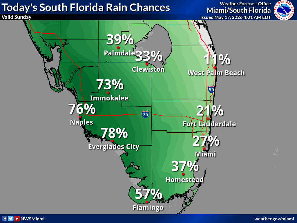
According to the latest South Florida Rain Chances map, probability of precipitation is highest across southwest Florida: 78% Everglades City, 76% Naples, 73% Immokalee, 57% Flamingo, 39% Palmdale, 37% Homestead, 33% Clewiston, 27% Miami, 21% Fort Lauderdale, and 11% West Palm Beach.
In addition to the thunderstorm risk, dangerously high heat indices are forecast this afternoon across much of South Florida. Values will peak as high as 105°F in Naples, 103°F in Everglades City, 102°F in Immokalee, 100°F in La Belle, 99°F in Buckhead Ridge, and 95–98°F across the eastern counties. Residents should take extra precautions against heat-related illnesses.
Copyright 2023-2025 FloridaWord.com

