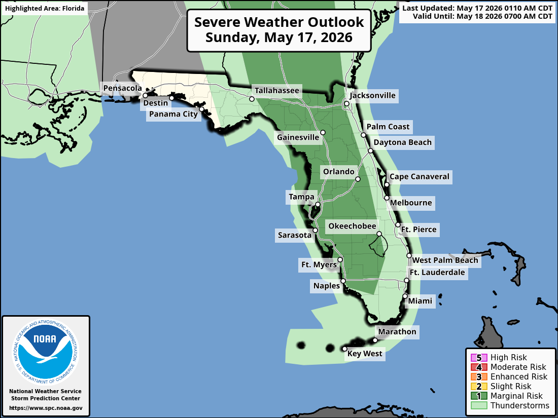
National Weather Service Storm Prediction Center Severe Weather Outlook for Florida on Sunday, May 17, 2026.
JACKSONVILLE, Florida – The National Weather Service Jacksonville has issued an update for isolated severe storms expected this afternoon and evening over inland northeast Florida and inland southeast Georgia, mainly along the I-75 corridor.
Isolated strong to severe thunderstorms are possible across the region this afternoon and evening, focused inland rather than along the coast.
According to NWS Jacksonville, isolated severe storms may develop this afternoon and evening, primarily inland along the I-75 corridor in northeast Florida and southeast Georgia.
Stronger storms on Sunday may produce:
North Florida and southeast Georgia areas at risk for thunderstorms include:
Sunday
Mostly sunny with isolated severe thunderstorms possible this afternoon and evening, mainly inland along the I-75 corridor. High near 88°F. Southeast wind 6 to 11 mph, with gusts as high as 18 mph. Hazards include damaging winds, hail, locally heavy downpours, and frequent lightning.
Sunday Night
Partly cloudy, with a low around 69°F. Southeast wind 6 to 11 mph, with gusts as high as 15 mph. Chance of lingering showers is low.
The NWS Jacksonville forecast indicates the main concerns remain damaging winds and hail with any stronger storms on Sunday, along with heavy rain and lightning. Coastal areas are expected to see lower chances overall.
Copyright 2023-2025 FloridaWord.com


