National Weather Service Storm Prediction Center Severe Weather Outlook for Florida on Tuesday, May 12, 2026.
JACKSONVILLE, Florida – The National Weather Service in Jacksonville reports beneficial rainfall continuing across southeast Georgia and northeast Florida through tonight, with embedded thunderstorms moving mainly along and south of I-10.
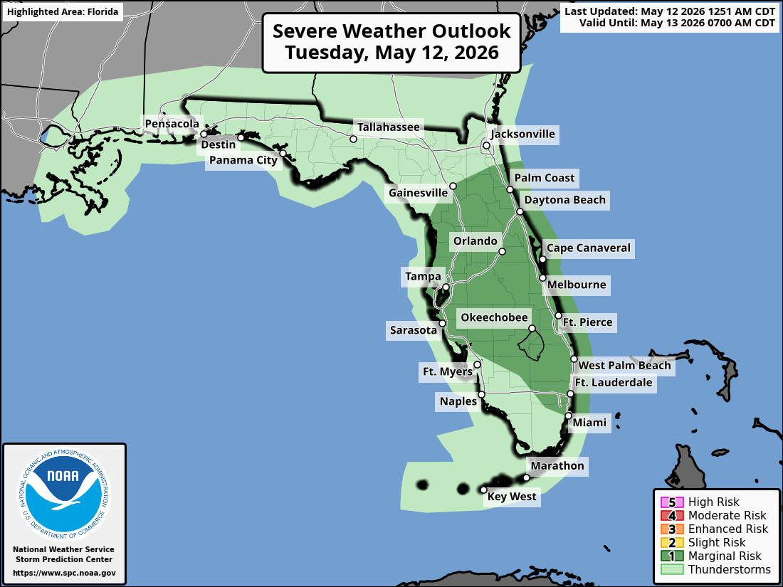
A strong storm is possible in north-central Florida this afternoon. Highest rainfall totals are expected along the northeast Florida coast as showers and thunderstorms provide much-needed relief amid ongoing drought conditions.
The National Weather Service in Jacksonville is alerting residents of the continued storm risk today. High temperatures will reach the low to mid 70s°F with breezy and muggy conditions. The primary threat from any stronger storms is damaging wind gusts of 40-60 mph.
According to NWS Jacksonville, stronger storms may develop with isolated strong to severe thunderstorms possible, mainly this afternoon through the evening.
Stronger storms on Tuesday may produce:
Isolated storms will continue overnight, but strong or severe impacts are not expected to persist. Ongoing extreme to exceptional drought conditions continue across the region. The storms are expected to bring widespread beneficial rainfall (three-quarters to one inch possible in spots), providing needed moisture amid the drought. Residents should practice wildfire prevention measures given the dry conditions and ongoing fire activity.
Northeast Florida areas at highest risk for thunderstorms and heavy rainfall include:
Today (Tuesday)
Showers and possibly a thunderstorm. High near 73. Northeast wind 10 to 14 mph, with gusts as high as 21 mph. Chance of precipitation is 90%. New rainfall amounts between three quarters and one inch possible. Hazards include damaging winds (40-60 mph), frequent lightning, locally heavy downpours, small hail, and a small chance of a brief tornado.
Tonight
Showers and thunderstorms likely before 3am, then a chance of showers. Low around 68. Northeast wind 5 to 10 mph becoming calm. Chance of precipitation 80%.
Copyright 2023-2025 FloridaWord.com


