
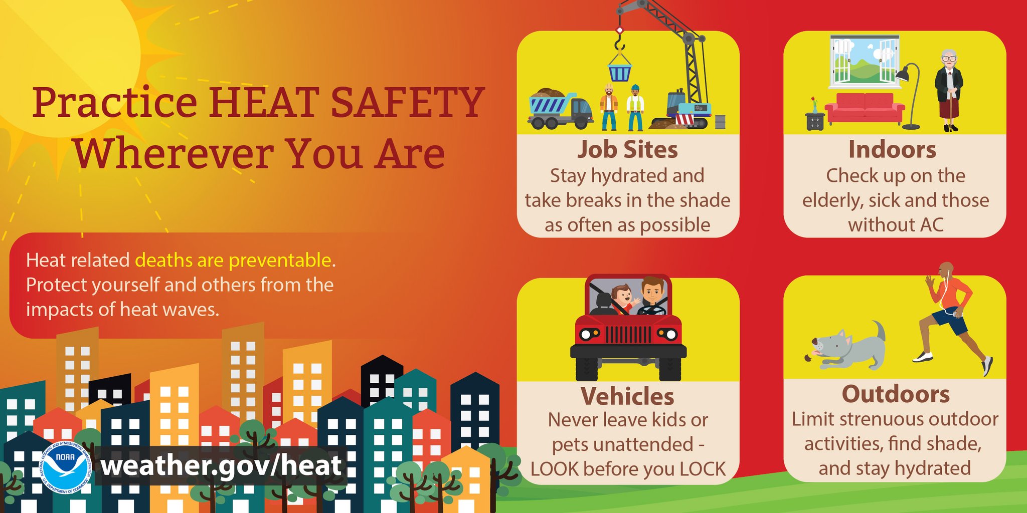
MIAMI, FL — The National Weather Service in Miami has issued a forecast of heat index values that will reach the upper 90s to 102°F this afternoon, Saturday, May 16, 2026.

A high risk of rip currents also continues through Sunday morning for Palm Beach County beaches, where currents can rapidly pull even strong swimmers offshore into deeper water.
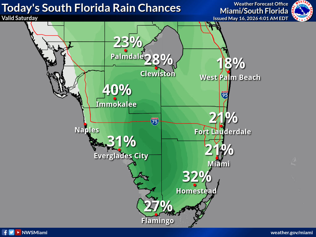
Rainfall chances today are generally low to moderate, with Fort Lauderdale at 21%, Miami at 21%, West Palm Beach at 18%, Homestead at 32%, Flamingo at 27%, and Immokalee at 40%, according to the NWS. Scattered showers and storms are possible, especially across interior South Florida and southwest Florida.

National Weather Service Miami South Florida Doppler Radar
Heat Exhaustion versus Heat Stroke
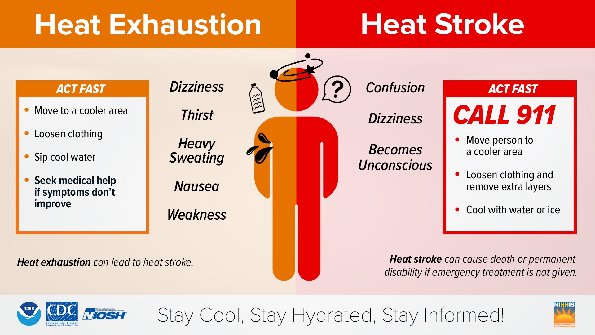
Take action when you see symptoms of heat exhaustion and heat stroke. To reduce risk during outdoor work, the Occupational Safety and Health Administration recommends scheduling frequent rest breaks in shaded or air-conditioned environments.
Rip Current Safety
Rip currents are powerful, narrow channels of fast-moving water that can pull swimmers away from shore.
If caught in a rip current:
- Stay calm — don’t fight the current.
- Swim parallel to the shore until you are free of the current.
- Then swim back to shore at an angle.
- If you can’t swim out, float or tread water and call or signal for help.
Always swim near lifeguards and heed the advice of local beach patrol flags and signs!
Anyone in distress in the water should signal for help immediately. Rip currents are a leading cause of beach rescues and fatalities — never turn your back on the ocean.
What is the Urban Heat Island Effect?
The urban heat island effect occurs when urban areas become much warmer—sometimes by as much as 20°F—than nearby rural landscapes, especially during summer.
According to NASA, this happens because cities have more heat-absorbing surfaces like asphalt, concrete, and buildings, and less vegetation to provide cooling through shade and evapotranspiration.