National Weather Service Miami South Florida Rain Chances Monday, May 11, 2026.
MIAMI, Florida – The National Weather Service in Miami is forecasting scattered to numerous showers and thunderstorms across interior South Florida this afternoon and evening on Monday, May 11, 2026.
The National Weather Service in Miami is forecasting high rain chances with showers and thunderstorms developing mainly between 2 PM and 10 PM. Cloudy and muggy conditions will persist before the activity ramps up.
The strongest storms could produce heavy rainfall, gusty winds (especially near Lake Okeechobee), frequent lightning, and small hail. There is a low chance of strong to damaging wind gusts near Lake Okeechobee (Marginal Risk – Level 1 of 5 from the Storm Prediction Center). Isolated urban flooding will be possible with the heaviest downpours.
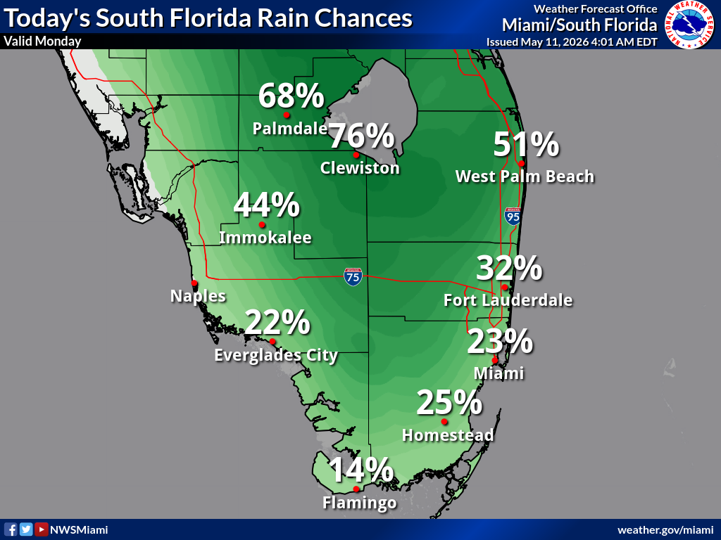
The highest rain chances are across the interior (especially near Lake Okeechobee): 76% Clewiston, 68% Palmdale, 51% West Palm Beach, 44% Immokalee, 32% Fort Lauderdale, 25% Homestead, 23% Miami, 22% Naples and Everglades City, and 14% Flamingo.
Copyright 2023-2025 FloridaWord.com

