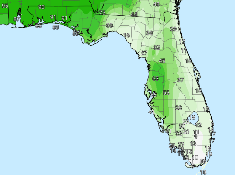
National Weather Service Rain Chances for Florida on Tuesday, May 26, 2026.
TALLAHASSEE, Florida – The National Weather Service Tallahassee has issued a Flood Watch for the Florida Panhandle, southeast Alabama, and southwest Georgia, effective immediately and extending through early Wednesday morning, May 27, 2026.
Residents are urged to prepare for heavy rain from thunderstorms today, with saturated soils from recent heavy rains combined with expected new storms posing the primary concern and potential for isolated flash flooding.
NWS meteorologists anticipate 1 to 3 inches of new rain across the affected areas today, with isolated locations possibly receiving up to 8 inches. The combination of saturated grounds and heavy rain from storms today increases the risk of significant water accumulation, particularly in low-lying and urban areas with poor drainage.
The Flood Watch covers portions of southeast Alabama, the Florida Panhandle, and southwest Georgia.
The NWS warns that excessive runoff could lead to flooding in rivers, creeks, streams, and other flood-prone locations. Storm drains and ditches may become clogged with debris, exacerbating the risk in urban areas.
While the heaviest rain is expected to be isolated, the risk of flash flooding is high today due to saturated grounds. Roads and low-lying areas may flood.
Temperatures are expected to remain in the mid-80s to low 90s Fahrenheit, thanks to persistent cloud cover and rainfall.
Copyright 2023-2025 FloridaWord.com