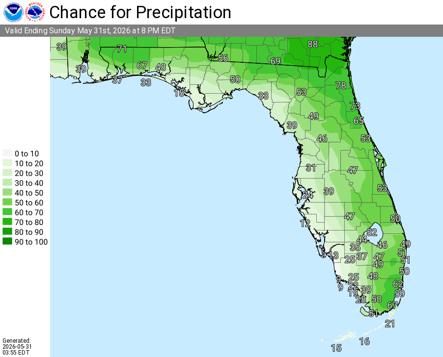
National Weather Service Rain Chances for Florida on Sunday, May 31, 2026.
TALLAHASSEE, Florida – The National Weather Service Tallahassee reports that the Flood Watch for the Florida Panhandle, southeast Alabama, and southwest Georgia has expired early this morning.
However, the persistent “rain train” pattern continues today and through early next week, bringing daily rounds of showers and thunderstorms with an elevated risk of localized flash flooding.
NWS Tallahassee warns of excessive rainfall potential today across southwest Georgia, southeast Alabama, and the Florida state line. Widespread rainfall amounts of 0.5 to 1.5 inches are expected, with isolated totals up to 5 inches possible, especially this afternoon into evening. Saturated soils from recent heavy rains will keep the threat of isolated flash flooding elevated.
Scattered to numerous showers and storms are expected each day, especially across our Florida and Georgia counties. In the strongest storms, locally heavy rain, gusty winds up to 40 mph, frequent lightning, and an elevated flash flood risk remain possible. A high risk of rip currents also continues at area beaches.
High temperatures are expected to reach the mid to upper 80s Fahrenheit due to persistent cloud cover and rainfall. Heat indices could still climb into the upper 90s to low 100s in any brief breaks from the rain.
The ongoing wet pattern will bring scattered to numerous showers and storms each day through early next week. Residents should remain vigilant and follow the safety advice: When thunder roars, go indoors. On the roads, slow down on wet pavement and never drive through flooded areas — Turn Around, Don’t Drown.
Copyright 2023-2025 FloridaWord.com