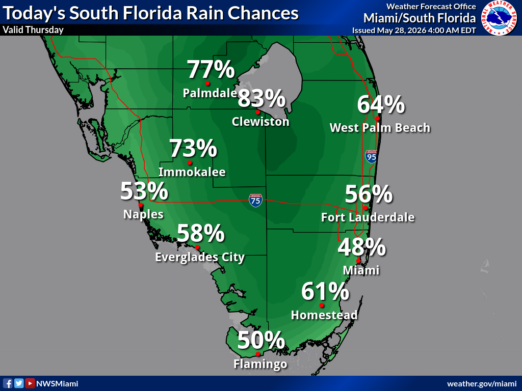
National Weather Service Miami South Florida Rain Chances – Thursday, May 28, 2026.
MIAMI, Florida – The National Weather Service in Miami warns that slow-moving thunderstorms over east coast metro areas of South Florida could lead to some minor flooding this morning on Thursday, May 28, 2026.
According to the NWS Miami graphic, a Limited risk of minor flooding exists from West Palm Beach south through Fort Lauderdale and Miami to Homestead. Storms are expected to continue slowly northward over the east coast metro areas through the morning hours with heavy rainfall. The highest impacts are most likely between 8–10 AM.
Today’s South Florida Rain Chances (NWS Miami) show the highest probabilities across the interior: 83% Clewiston, 77% Palmdale, 73% Immokalee, 64% West Palm Beach, 61% Homestead, 58% Everglades City, 56% Fort Lauderdale, 53% Naples, 50% Flamingo, and 48% Miami.
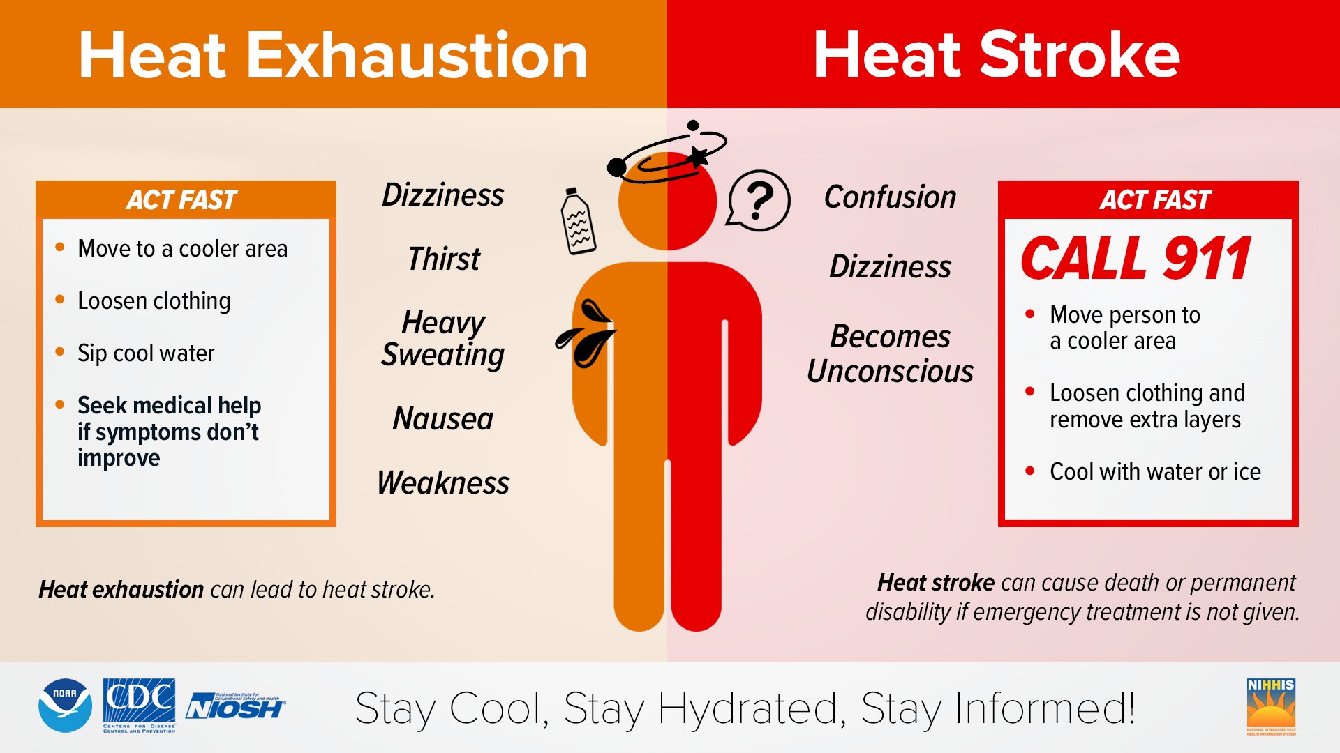
Dangerously high heat indices are forecast this afternoon across much of South Florida. Values will peak as high as 103°F in Naples and Buckhead Ridge, 102°F in Immokalee and Everglades City, 100°F in La Belle, Belle Glade, and West Palm Beach, and 99°F in Fort Lauderdale, Miami, Homestead, and Flamingo. Residents should take extra precautions against heat-related illnesses.
Take action when you see symptoms of heat exhaustion and heat stroke. To reduce risk during outdoor work, the Occupational Safety and Health Administration recommends scheduling frequent rest breaks in shaded or air-conditioned environments.
Copyright 2023-2025 FloridaWord.com