National Weather Service Miami South Florida Rain Chances April 25, 2026
MIAMI, Florida – The National Weather Service Storm Prediction Center (SPC) has issued a Marginal Risk (Level 1) of severe thunderstorms for portions of South Florida on Saturday, April 25, 2026.
The risk area primarily covers inland portions of South Florida, with a conditional threat of a few strong to marginally severe storms developing this afternoon — especially near Lake Okeechobee and surrounding areas.
The National Weather Service in Miami is monitoring the Marginal Risk of severe thunderstorms across South Florida today. Isolated stronger storms could produce gusty winds, small hail, heavy rain, and excessive lightning. Storms are most likely to develop mid to late afternoon (roughly 2 PM – 7 PM), driven by sea-breeze boundaries.
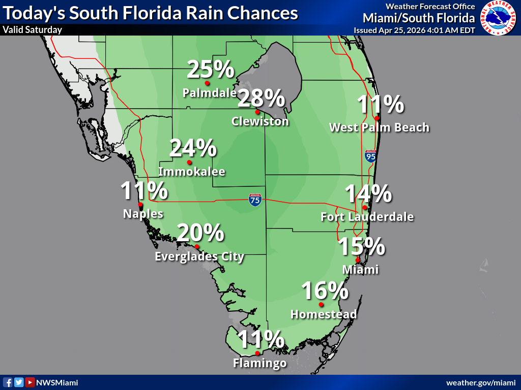
According to the latest South Florida Rain Chances map, probability of precipitation is generally low across the region. Highest chances are inland: 28% Clewiston, 25% Palmdale, 24% Immokalee, and 20% Everglades City. Coastal and eastern areas are lower: Miami 15%, Homestead 16%, Fort Lauderdale 14%, West Palm Beach 11%, Naples 11%, and Flamingo 11%.
Copyright 2023-2025 FloridaWord.com

