National Weather Service Storm Prediction Center Severe Weather Outlook for Florida on Thursday, April 23, 2026.
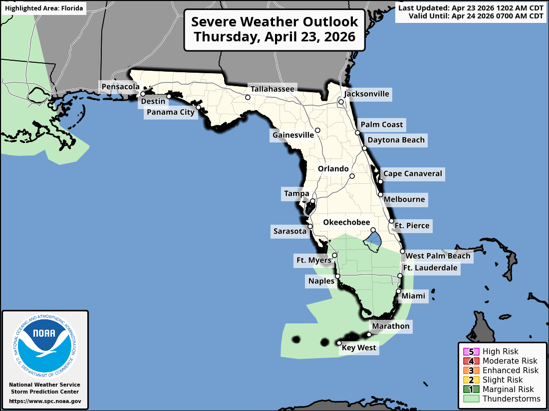
MIAMI, Florida – The National Weather Service Storm Prediction Center (SPC) has issued a Marginal Risk (Level 1) of severe thunderstorms for portions of South Florida on Thursday, April 23, 2026.
The risk area covers the East Coast metro corridor from Okeechobee southward through Miami, West Palm Beach, Fort Lauderdale and into the Florida Keys, as well as parts of southwest Florida.
The National Weather Service in Miami is monitoring a Marginal Risk of severe thunderstorms across South Florida today. Isolated stronger storms could produce heavy rain, gusty winds, and a low chance of small hail. Scattered showers remain possible, with the best chances during the afternoon hours.
According to the latest South Florida Rain Chances map, probability of precipitation is generally low across the region, ranging from 11% in areas like Jupiter, Homestead, and Miami to as high as 25% near Everglades City. Most locations fall in the 11-21% range.
A High Risk of Rip Currents continues along all east coast beaches through Friday. Breezy onshore winds are creating hazardous surf conditions. Beachgoers are urged to swim only in lifeguarded areas and heed beach flags.
Copyright 2023-2025 FloridaWord.com

