National Weather Service Rain Chances for Florida April 6, 2026.
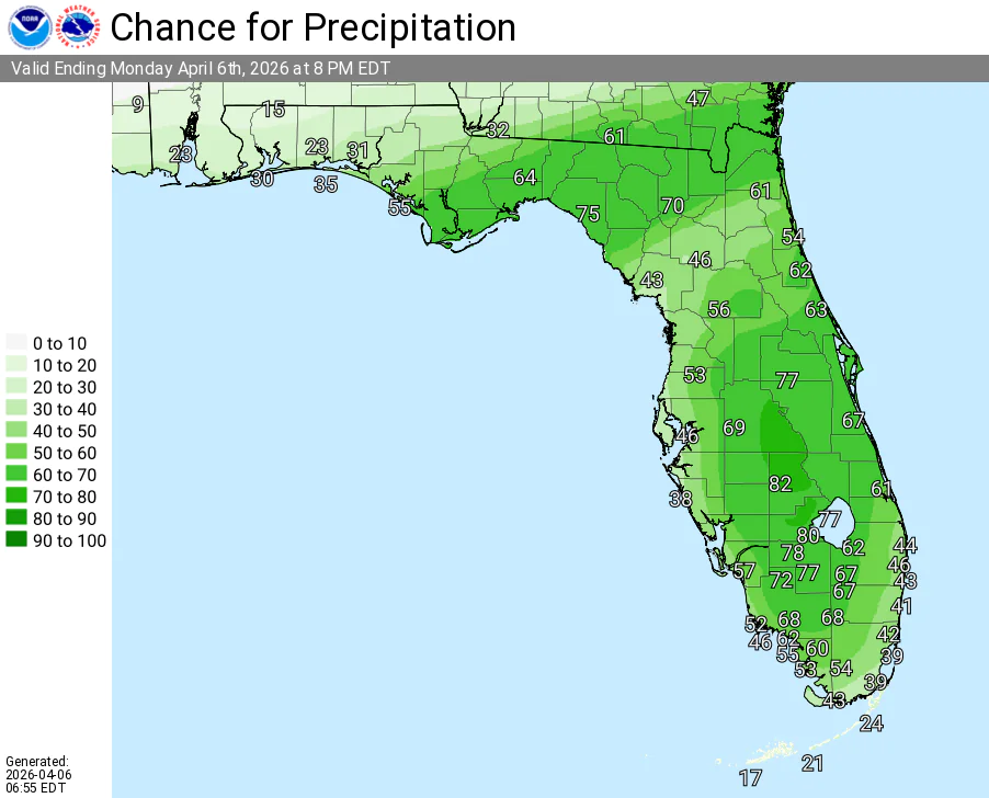
ORLANDO, Florida – The National Weather Service in Melbourne has issued the forecast for East Central Florida on Monday, April 6, 2026, as a cold front settles across the area bringing high rain and storm chances with locally heavy rain.
Numerous showers and thunderstorms are expected to develop across the Florida Peninsula this afternoon and continue into tonight.
Locally heavy rainfall could lead to temporary flooding of urban and poorly drained areas. Increased rain, wind, and coastal impacts are expected to develop midweek.
The NWS warns of the following hazards:
According to the National Weather Service in Melbourne, the strongest activity is expected in the afternoon and evening, with showers and storms continuing into tonight. High rip current risk continues through the week. Beach-goers are advised to stay out of the ocean.
East Central Florida cities expecting high rain chances include:
Today
A quiet morning, then numerous showers and thunderstorms developing this afternoon with locally heavy rain possible. High near 81°F. Chance of precipitation 70%. South winds becoming gusty.
Tonight
Showers and thunderstorms likely continuing, becoming mostly cloudy. Low around 64°F. Winds becoming northwest.
Copyright 2023-2025 FloridaWord.com


