National Weather Service Rain Chances for Florida April 4, 2026.
ORLANDO, Florida – The National Weather Service in Melbourne has provided the Easter Sunday forecast for East Central Florida on Sunday, April 5, 2026. An increase in shower and storm chances is expected, particularly this afternoon.
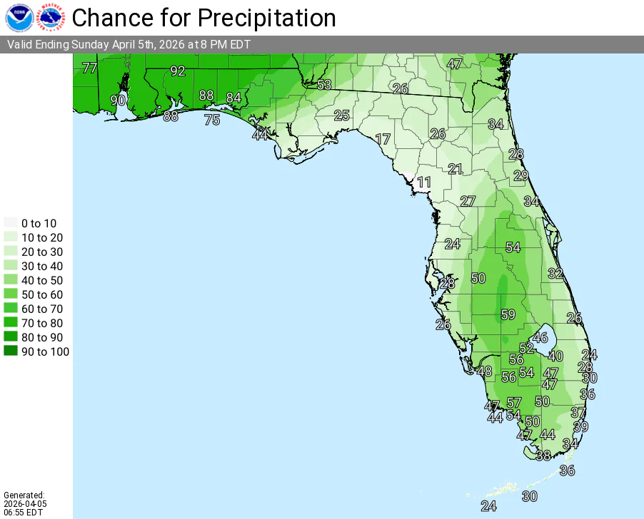
Scattered showers and isolated thunderstorms are anticipated across portions of East Central Florida this afternoon, mainly across the interior, with breezy conditions along the coast.
Locally heavy rainfall is possible.
The NWS warns of the following hazards today:
According to the National Weather Service in Melbourne, higher rain chances (30-50%) are in store today with scattered afternoon showers and isolated storms possible across East Central Florida, mainly in the interior.
High rip current risk persists at all Central Florida Atlantic beaches from the Daytona, Space, and Treasure Coasts. Beachgoers are strongly advised to stay out of the water.
Looking ahead, another front is set to arrive this week, delivering increased rain, wind, and coastal impacts, with the greatest concern Tuesday through Thursday.
East Central Florida cities forecast for Easter Sunday:
Today (Sunday – Easter)
Scattered showers and isolated thunderstorms possible, especially this afternoon mainly in the interior. High near 86°F. Chance of precipitation 40%. East winds 10-15 mph.
Tonight
Showers and storms gradually ending, becoming partly cloudy. Low around 67°F.
Copyright 2023-2025 FloridaWord.com

