National Weather Service Storm Prediction Center Severe Weather Outlook for Florida on Tuesday, April 28, 2026.
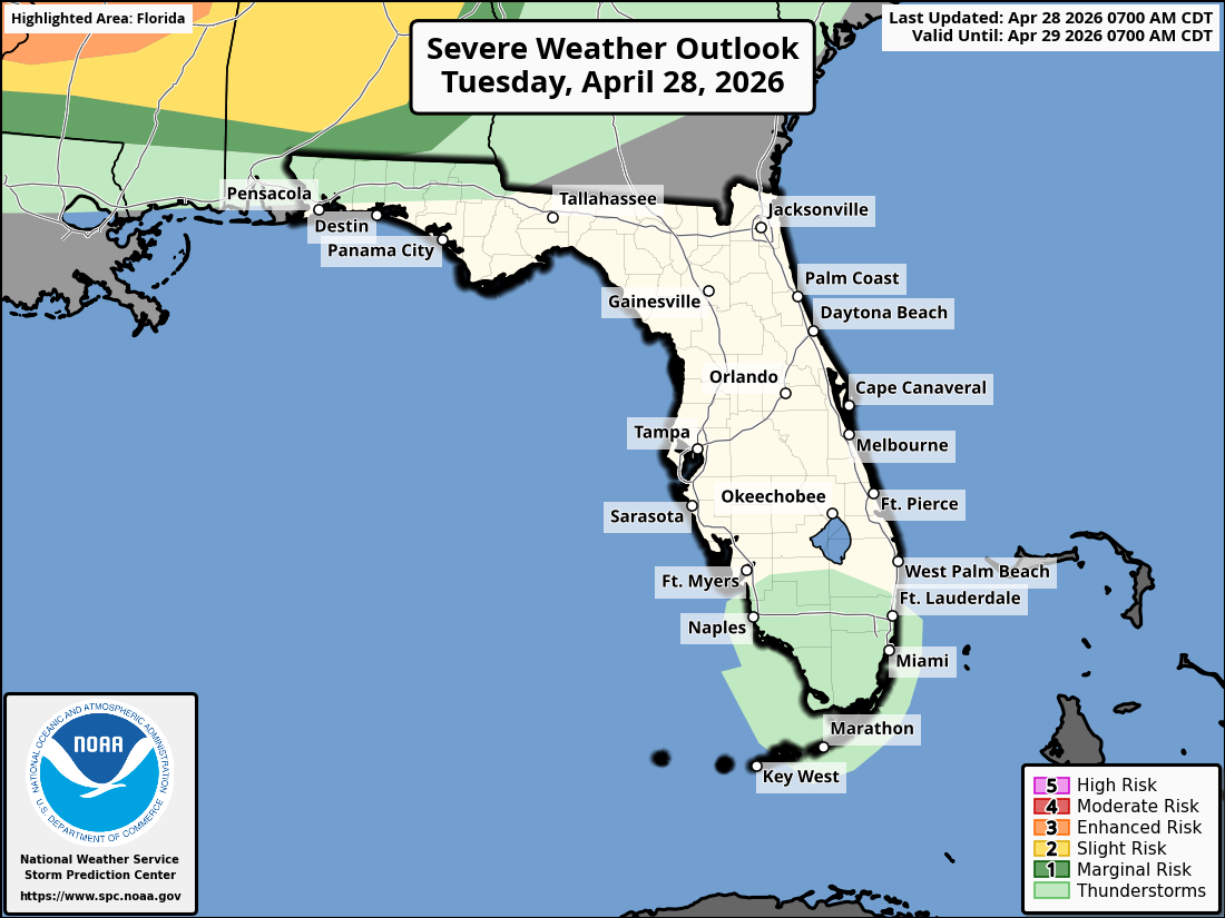
TALLAHASSEE, Florida – The National Weather Service Storm Prediction Center has outlined a Marginal Risk (Level 1 of 5) of strong to severe thunderstorms across parts of southeast Alabama’s Wiregrass region and the Florida Panhandle for tonight and Wednesday night, April 28-29, 2026.
According to the National Weather Service Tallahassee, isolated strong to severe storms are possible tonight from an incoming storm cluster and Wednesday night from a cold front. The most at-risk areas include southeast Alabama’s Wiregrass region and parts of the Florida Panhandle along the I-10 corridor.
The primary hazards with any stronger storms include isolated damaging wind gusts of 40-60 mph and hail up to one inch in diameter. Lightning is a concern across the region as thunderstorms develop.
Cities at risk for thunderstorms and possible strong to severe weather include:
High temperatures across the Florida Panhandle and north Florida will be in the mid to upper 80s today with lows in the mid 60s overnight.
Copyright 2023-2025 FloridaWord.com


