National Weather Service Miami South Florida Rain Chances April 26, 2026
MIAMI, Florida – The National Weather Service Storm Prediction Center has issued a marginal risk (Level 1/5) severe weather outlook for South Florida due to the potential for severe thunderstorms expected to impact the region on Sunday, April 26, 2026.
The National Weather Service in Miami is forecasting scattered showers and thunderstorms to develop across the interior and east coast metro areas this afternoon.
The strongest storms could produce gusty winds, heavy downpours, and small hail. Storms are most likely to develop mid-to-late afternoon (roughly 2 PM – 7 PM), driven by daytime heating and sea-breeze boundaries.
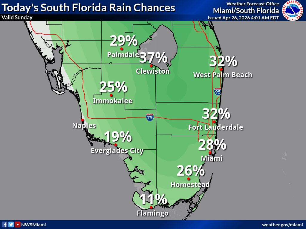
The highest rain chances are inland and along the east coast: 37% Clewiston, 32% West Palm Beach, 32% Fort Lauderdale, 29% Palmdale, 28% Miami, 26% Homestead, 25% Immokalee, 19% Everglades City / Naples area, and 11% Flamingo.
Copyright 2023-2025 FloridaWord.com

