National Weather Service Florida Rain Chances Saturday, April 25, 2026.
TALLAHASSEE, Florida – The National Weather Service Storm Prediction Center issued a severe weather outlook for Florida on Saturday, April 25, 2026, with a Marginal Risk (Level 1 of 5) of strong to severe thunderstorms across parts of the Florida Panhandle.
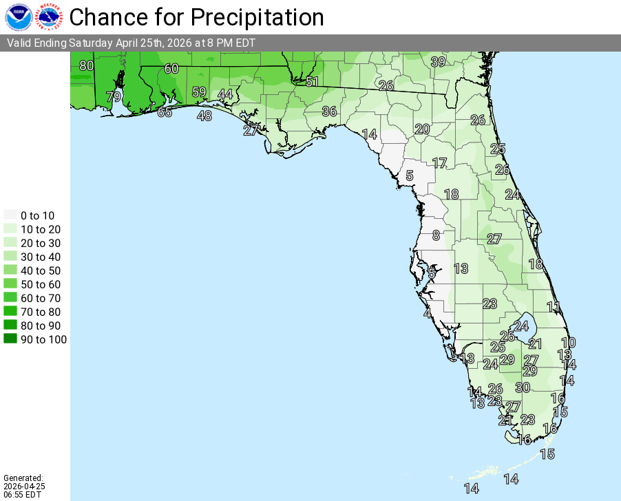
According to the latest probability of precipitation forecast valid through 8 PM EDT, showers and thunderstorms are likely this afternoon and evening with the highest chances (60-80%+) across the western Panhandle, decreasing eastward and southward. Not everyone will see rain — the activity will be scattered.
The primary hazards with any stronger storms include damaging wind gusts and small hail. Lightning is a concern across the region as thunderstorms develop.
Cities at risk for thunderstorms and possible strong to severe weather include:
High temperatures across the Florida Panhandle and north Florida will be in the upper 70s to low 80s today with lows in the mid 60s overnight.
Following today’s activity, conditions are expected to become more tranquil with milder temperatures persisting into next week.
Copyright 2023-2025 FloridaWord.com

