MIAMI, Florida – The National Weather Service in Miami forecasts that scattered showers and isolated thunderstorms remain possible across South Florida today, with the best chances during the afternoon hours on Friday, April 24, 2026.
A High Risk of Rip Currents continues along all east coast beaches through this evening. Breezy onshore winds are creating hazardous surf conditions. Beachgoers are urged to swim only in lifeguarded areas and heed beach flags.
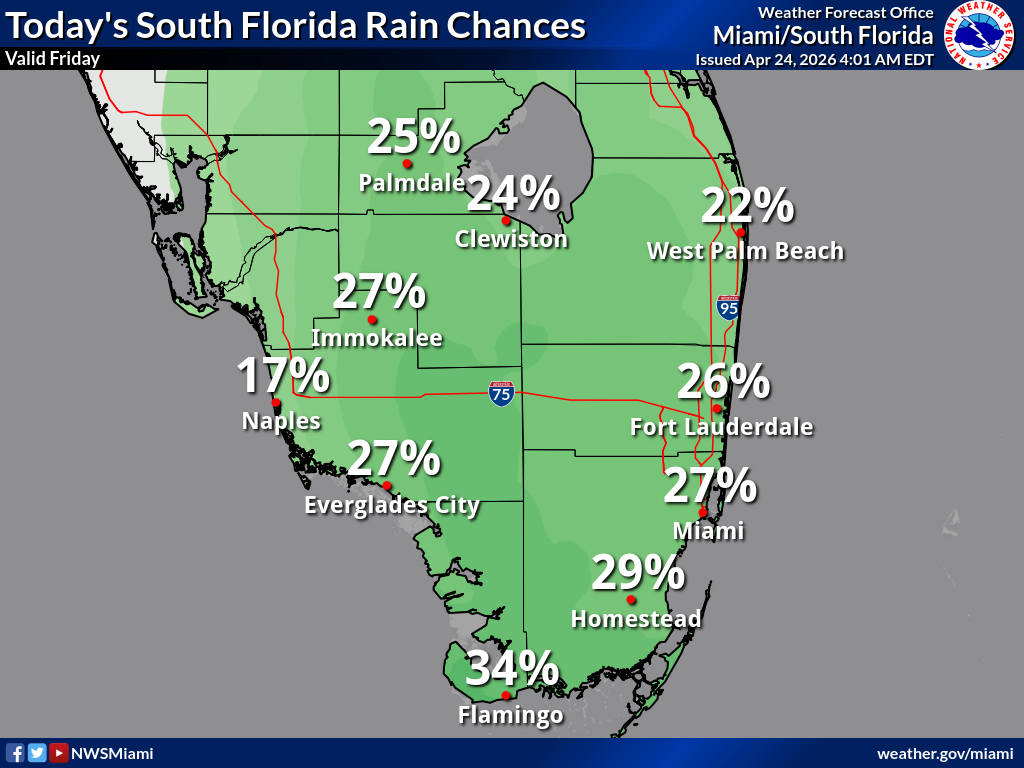
Friday
Partly sunny with a slight chance of showers and thunderstorms, mainly in the afternoon. High near 79°F. East wind 10 to 15 mph, with gusts as high as 23 mph. Chance of precipitation is 20%. High rip current risk remains in effect for Atlantic beaches.
Friday Night
Mostly cloudy, with a low around 70°F. East wind around 14 mph, with gusts as high as 22 mph. Chance of showers 20%.
Saturday
A 20 percent chance of showers and thunderstorms after 2pm. Sunny, with a high near 81. Southeast wind 5 to 9 mph.
Saturday Night
A 10 percent chance of showers and thunderstorms before 8pm. Partly cloudy, with a low around 73. Southeast wind around 7 mph.
Sunday
A 20 percent chance of showers and thunderstorms after 2pm. Sunny, with a high near 82. Light south wind increasing to 5 to 9 mph in the morning.
Sunday Night
A 10 percent chance of showers and thunderstorms before 8pm. Partly cloudy, with a low around 74. South wind 3 to 6 mph.
Monday
Sunny, with a high near 82. Calm wind becoming southeast 5 to 9 mph in the afternoon.
Monday Night
Partly cloudy, with a low around 75.