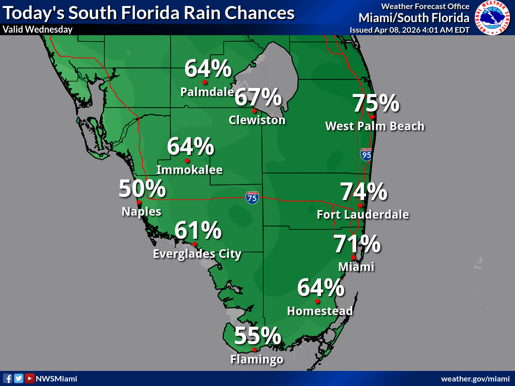
National Weather Service Miami South Florida Rain Chances April 8, 2026.
MIAMI, Florida – The National Weather Service in Miami reports that a Flood Watch remains in effect for the east coast metro area until 10 PM this evening due to the continued threat of heavy rainfall across Southeast Florida.
Additional 1-2 inches of rain are expected with localized amounts of 3-5 inches possible. This creates a slight risk (15-39%) of excessive rainfall and flooding in urban, low-lying, and poor drainage areas.
Dangerous marine and beach conditions will persist through the end of the week. High risk of rip currents continues along South Florida‘s Atlantic beaches. Beachgoers are urged to swim only at lifeguarded beaches and heed all warnings. Boaters should use extra caution as seas remain hazardous with 10-15+ foot waves, Small Craft Advisories, and High Surf Advisory (Palm Beach County) in effect.
Copyright 2023-2025 FloridaWord.com

