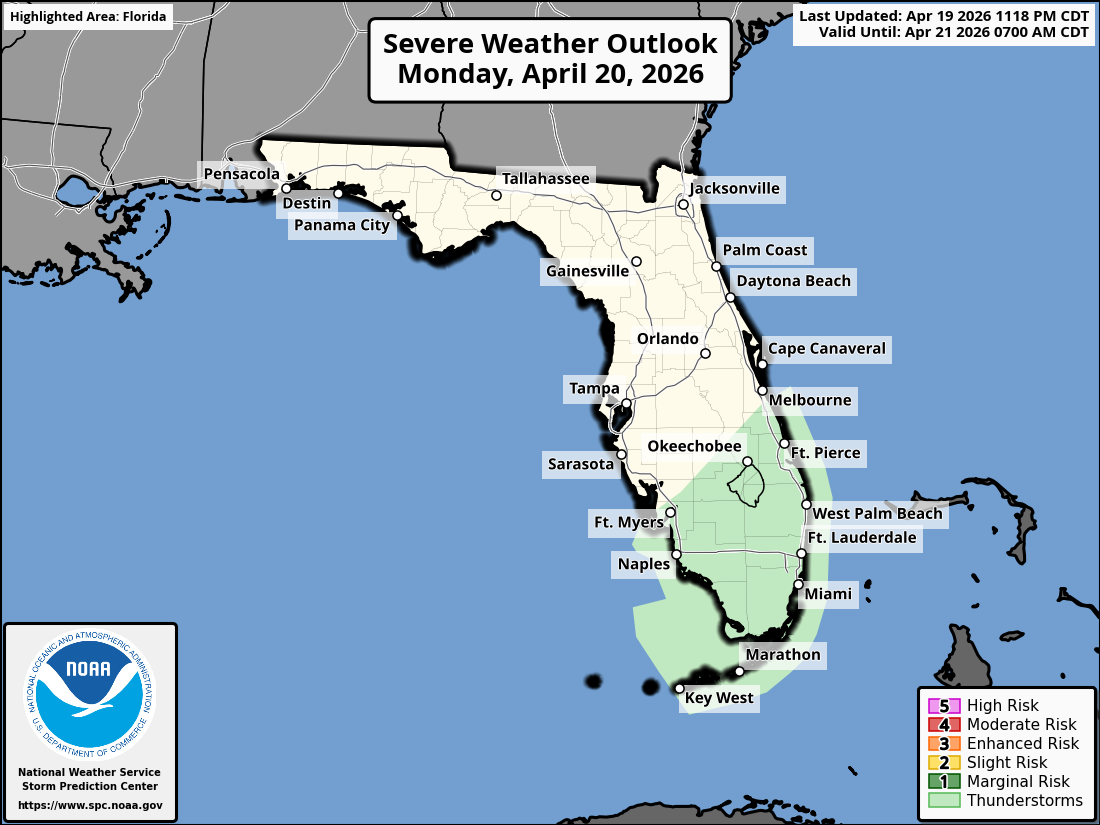
SPC Severe Weather Outlook, April 20, 2026 – Marginal Risk for Thunderstorms in South Florida
MIAMI, Florida – The Storm Prediction Center (SPC) has issued a Marginal Risk (Level 1) of severe thunderstorms for portions of South Florida on Monday, April 20, 2026. The risk area covers the East Coast metro corridor from Okeechobee southward through Miami, West Palm Beach, Fort Lauderdale and into the Florida Keys, as well as parts of southwest Florida.
The National Weather Service in Miami forecasts a cold front moving into South Florida today, triggering scattered showers and thunderstorms. Activity begins early this morning near Lake Okeechobee and shifts to the East Coast metro and southwest areas by afternoon.
Stronger storms may produce heavy downpours with localized urban flooding, gusty winds of 30-35 mph, and a low chance of penny-sized hail.
Breezy post-frontal conditions will create a high rip current risk along Atlantic beaches this week, with hazardous surf up to 6-8 feet near the Palm Beaches and small craft advisories for Atlantic and Gulf waters.
Copyright 2023-2025 FloridaWord.com
