National Weather Service Rain Chances for Florida April 4, 2026.
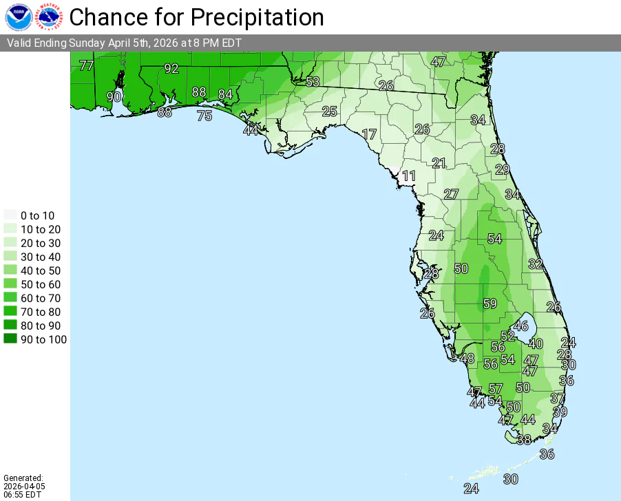
TAMPA BAY, Florida – The National Weather Service Tampa Bay has forecast scattered to numerous showers and thunderstorms this afternoon and evening, with the highest chances over the interior and across portions of southwest Florida on Sunday, April 5, 2026.
Isolated to scattered showers and thunderstorms are expected along the Nature Coast and coastal areas, while scattered to numerous activity is favored inland and across southwest Florida.
Heavy downpours in any stronger storms could lead to localized minor flooding.
The National Weather Service (NWS) Tampa Bay is forecasting increasing chances of showers and thunderstorms for Sunday, April 5, 2026, particularly across the interior and southwest portions of the Florida peninsula.
Rain chances range from around 20-30% along the coasts to 50-60% or higher in the central interior and southwest Florida (highest near Lakeland and Sebring).
High temperatures will reach the mid to upper 80s°F under mostly sunny skies becoming increasing cloudy.
Thunderstorms are most likely during the afternoon and early evening hours (generally 1 PM – 9 PM EDT), with timing varying by location.
Rain chances will continue to increase Monday through the middle of the week as a cold front moves through and moisture holds across the area.
Copyright 2023-2025 FloridaWord.com


