National Weather Service Storm Prediction Center Severe Weather Outlook for Florida March 16, 2026
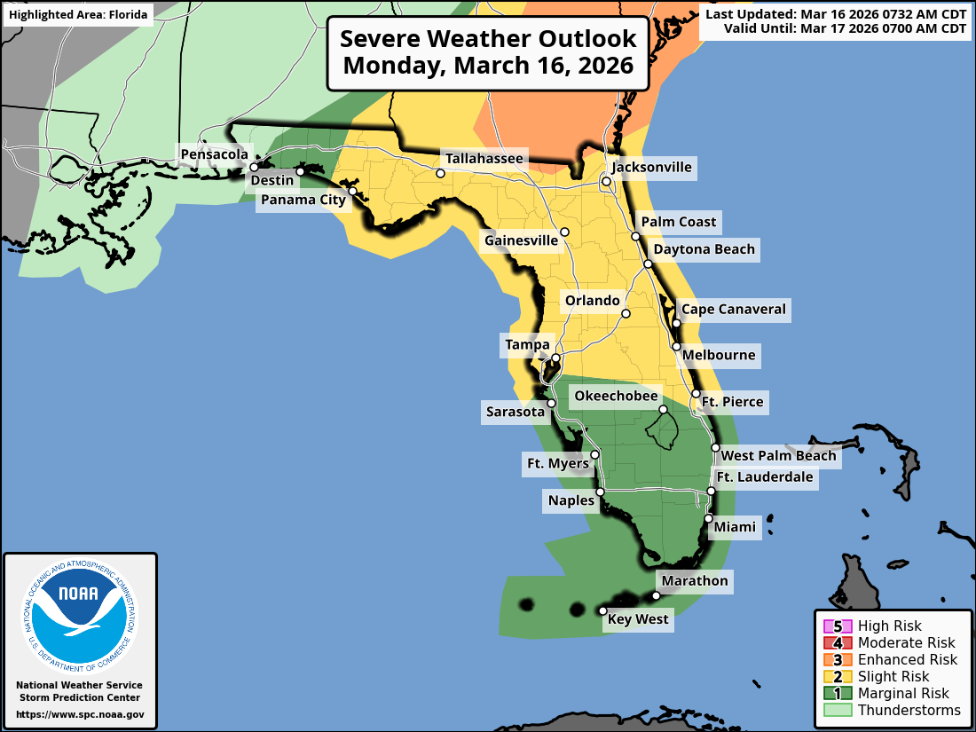
TAMPA BAY, Florida – The National Weather Service Storm Prediction Center has issued a Slight Risk (Level 2 out of 5) of severe thunderstorms for northern and central Florida, including west central areas, on Monday, March 16, 2026.
Thunderstorms will move across the Florida peninsula today, with strong to severe thunderstorms possible. Scattered showers and thunderstorms are anticipated across the Florida Peninsula today and continuing into the week due to an unsettled weather pattern.
Heavy downpours could lead to localized flash flooding over portions of Florida through mid-week.
The National Weather Service (NWS) Tampa Bay has issued a severe weather outlook for Monday, March 16, 2026, warning of a slight risk (level 2 out of 5) for severe storms across northern and central Florida, including west central and southwest Florida.
The potential hazards include gusty/damaging winds, large damaging hail, isolated tornadoes, along with lightning and heavy rainfall.
The forecast covers areas such as Tampa, St. Petersburg, Sarasota, and Fort Myers. Highest threat from Tampa Bay and the central Florida peninsula northward.
Thunderstorms are expected from 11 AM to 9 PM EDT, with timing varying by zone: Most likely 11 AM – 3 PM in northern areas (Zone A), 2 PM – 6 PM in central (Zone B), and 5 PM – 9 PM in southern (Zone C).
A line of strong to severe thunderstorms will reach the Nature Coast around midday and exit southern areas by evening. Be sure to have multiple ways to receive weather warnings.
Copyright 2023-2025 FloridaWord.com


