National Weather Service Storm Prediction Center Severe Weather Outlook for Florida March 15, 2026
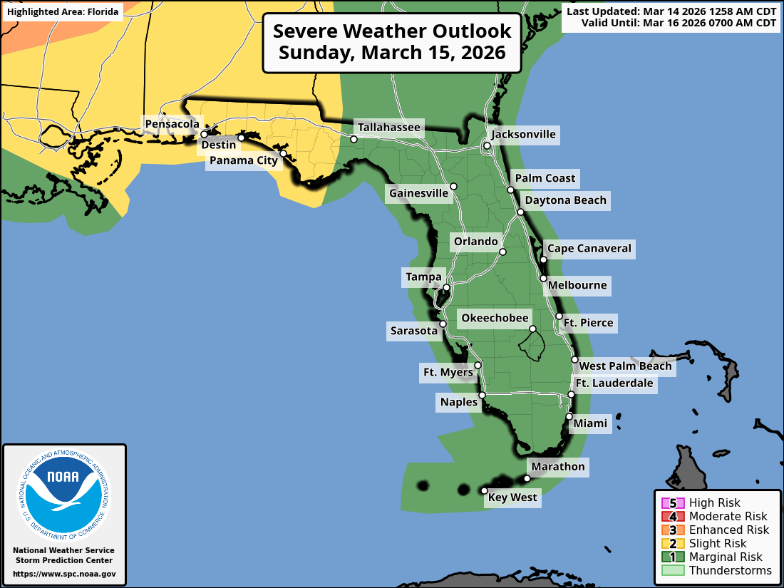
ORLANDO, Florida – The National Weather Service Storm Prediction Center has issued a Severe Weather Outlook for Central Florida on Sunday, March 15, 2026, due to a marginal risk of severe thunderstorms.
Scattered thunderstorms are anticipated across the Florida Peninsula, influenced by an approaching strong cold front producing showers and storms.
Heavy rainfall could lead to localized flash flooding over portions of Florida through mid-week.
The NWS warns of the following hazards during the peak storm hours:
According to the National Weather Service in Melbourne, the strongest storms are expected in the afternoon and evening from approximately 2 PM to 9 PM EDT, with a marginal risk for severe storms continuing into Monday.
Central Florida cities at risk for severe thunderstorms include:
Today
A quiet morning, then numerous showers and lightning storms developing this afternoon. High near 85°F. Chance of precipitation is 80%. South wind around 9 mph.
Tonight
Partly cloudy, with a slight chance of showers and thunderstorms before midnight. Low around 66°F. Chance of precipitation is 20%.
Copyright 2023-2025 FloridaWord.com


