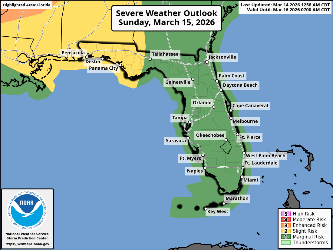
National Weather Service Storm Prediction Center Severe Weather Outlook for Florida March 15, 20261
TALLAHASSEE, Florida – The National Weather Service Storm Prediction Center issued a severe weather outlook for Southeast Alabama, Southwest Georgia, the Florida Panhandle, and Big Bend due to a Marginal to Slight Risk (Level 1 and 2 of 5) of strong to severe thunderstorms late Sunday night into Monday, March 15-16, 2026.
According to the National Weather Service Tallahassee, a line of strong to severe storms will move across southeast Alabama and southwest Georgia late Sunday night into Monday morning, impacting the Florida Panhandle and Big Bend during the morning and afternoon.
The primary hazards are damaging wind gusts of 40 to 70 mph and a few brief tornadoes.
Secure loose outdoor items and exercise caution when driving high-profile vehicles.
The greatest chance for severe weather is across southeast Alabama and the Florida Panhandle. Cities at risk for severe weather include:
The rain and cloud coverage will bring some much needed relief to the Florida Panhandle, but it will not be enough to end the ongoing severe to extreme drought.
High temperatures across the Florida Panhandle will be in the upper 70s to low 80s on Sunday with lows in the mid 60s overnight.
Following the passage of the cold front, conditions will become more tranquil with partly sunny skies and mild temperatures in the 70s persisting through much of the following week.
Copyright 2023-2025 FloridaWord.com


