National Weather Service Storm Prediction Center Severe Weather Outlook for Florida March 16, 2026
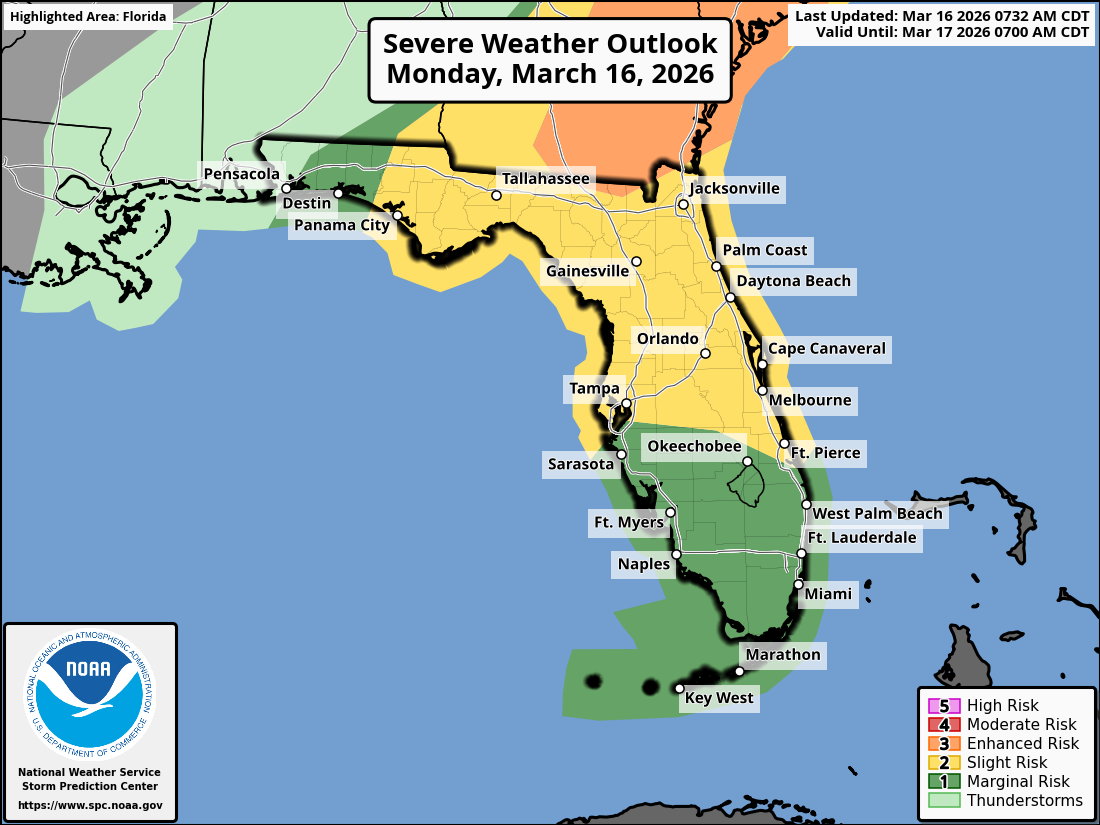
JACKSONVILLE, Florida – The National Weather Service Storm Prediction Center has issued a weather alert for North Florida and southeast Georgia on Monday, March 16, 2026, due to risks of strong-to-severe thunderstorms. As of March 16, 2026, at 9:24 AM EDT, the risk for Monday has been upgraded to Moderate (4/5), with active tornado warnings and a Tornado Watch in effect until 2 PM EDT for parts of Florida, Georgia, and South Carolina.
Thunderstorm activity is developing ahead of an approaching cold front, affecting northeast Florida and southeast Georgia during the afternoon and evening on Monday with increased severity. Storms began in southeast Georgia and the Suwannee Valley around 9 AM EDT on Monday, spreading southeast through the day, with severe activity expected to move south of the area by early evening.
According to NWS Jacksonville, scattered strong-to-severe thunderstorms are occurring on Monday under a Moderate (4/5) risk across the region. Primary impacts are occurring across northeast Florida and southeast Georgia, with ongoing tornado warnings for areas including Alma GA, Lake City FL, Douglas GA, Nicholls GA, Pearson GA, and others as of early Monday morning.
On Monday, main storm hazards include:
Additionally, increased wildfire danger persists due to ongoing extreme drought conditions affecting over 90% of the region. Practice wildfire prevention measures, especially under burn bans or water restrictions.
Widespread beneficial rainfall is expected on Monday, which may help alleviate drought conditions but could lead to brief localized flooding in urban, low-lying, or poorly drained areas.
North Florida and southeast Georgia areas at risk for thunderstorms include:
Monday
Severe thunderstorms expected this afternoon and evening, with scattered severe thunderstorms from late morning through afternoon. High near 82°F. Windy, with a south wind 13 to 18 mph, with gusts as high as 29 mph. Severe weather risks include damaging winds and isolated tornadoes.
Monday Night
A 20% chance of showers before 2am. Low around 36°F. Breezy. Freeze Watch in effect for portions of inland southeast Georgia into Tuesday morning.
The NWS Jacksonville forecast indicates widespread beneficial rainfall with these storms, providing needed moisture amid ongoing drought conditions, while the primary concerns remain damaging winds, isolated tornadoes, and potential for strong, long-track tornadoes on Monday.
Copyright 2023-2025 FloridaWord.com


