National Weather Service Storm Prediction Center Severe Weather Outlook for Florida March 16, 2026
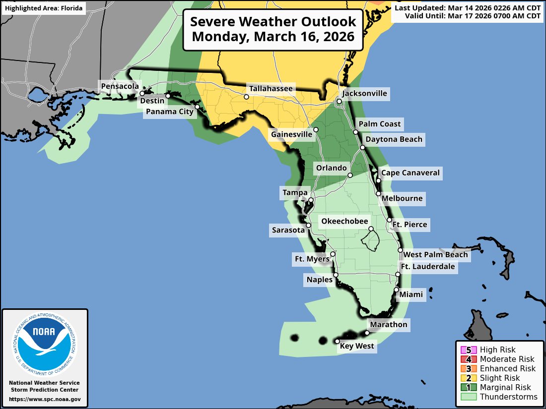
JACKSONVILLE, Florida – The National Weather Service Storm Prediction Center has issued a weather alert for North Florida and southeast Georgia on Sunday, March 15, 2026, and Monday, March 16, 2026, due to risks of strong-to-severe thunderstorms.
Thunderstorm activity is expected to develop ahead of an approaching cold front, affecting northeast Florida and southeast Georgia during the afternoon and evening on both days.
According to NWS Jacksonville, isolated strong-to-severe thunderstorms may develop on Sunday under a Marginal (1/5) risk level, mainly near the I-95 corridor in northeast Florida, with scattered strong-to-severe thunderstorms on Monday under a Slight (2/5) risk for southeast Georgia and portions of northeast Florida, and Marginal (1/5) elsewhere. Primary impacts are expected across northeast Florida and southeast Georgia.
Stronger storms on Sunday may produce:
On Monday, main storm hazards include:
Additionally, increased wildfire danger is expected due to ongoing extreme drought conditions affecting over 90% of the region. Practice wildfire prevention measures, especially under burn bans or water restrictions.
Widespread beneficial rainfall is expected Sunday into Monday, which may help alleviate drought conditions but could lead to brief localized flooding in urban, low-lying, or poorly drained areas.
North Florida and southeast Georgia areas at risk for thunderstorms include:
Sunday
Chance of showers and thunderstorms after 2pm, with isolated severe thunderstorms possible in the afternoon and evening. High near 86°F. Light and variable wind becoming south 5 to 10 mph in the afternoon, gusts up to 15 mph. Chance of precipitation is 30%. Hazards include gusty winds, small hail, locally heavy downpours, and frequent lightning.
Sunday Night
Showers likely and possibly a thunderstorm before 8pm, then a chance of showers and thunderstorms after 8pm. Low around 67°F. South wind 6 to 9 mph. Chance of precipitation is 60%.
Monday
Showers and possibly a thunderstorm, with scattered severe thunderstorms possible from late morning through afternoon. High near 81°F. Breezy, with a south wind 13 to 18 mph, with gusts as high as 29 mph. Chance of precipitation is 90%.
Monday Night
A 20% chance of showers before 2am. Low around 39°F. Breezy.
The NWS Jacksonville forecast indicates widespread beneficial rainfall is expected with these storms, providing needed moisture amid ongoing drought conditions, while the primary concerns remain damaging winds and possible tornadoes on Monday.
Copyright 2023-2025 FloridaWord.com


