National Weather Service Storm Prediction Center Severe Weather Outlook for Florida February 21, 2026
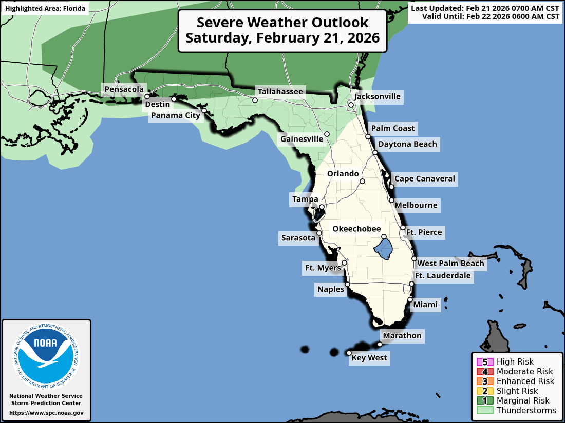
TALLAHASSEE, Florida – The National Weather Service Storm Prediction Center issued a severe weather outlook for Southeast Alabama, Southwest Georgia, the Florida Panhandle, and Big Bend due to a Marginal Risk (Level 1 of 5) of strong to severe thunderstorms on Saturday, February 21, 2026.
According to the National Weather Service Tallahassee, a line of strong thunderstorms will move across southeast Alabama and southwest Georgia this afternoon, impacting the Florida Panhandle and Big Bend during the evening.
The primary hazards are damaging wind gusts, a few tornadoes, and large hail.
Gusty winds of 25-35 mph are anticipated ahead of the thunderstorms, with potential for 40 mph or greater gusts. Secure loose outdoor items and exercise caution when driving high-profile vehicles. Gale Warnings and Small Craft Advisories are in effect for the northeastern Gulf.
The greatest chance for severe weather is across the Florida Panhandle. Cities at risk for severe weather include:
The rain and cloud coverage will bring some much needed relief to the Florida Panhandle, but it will not be enough to end the ongoing moderate to severe drought.
High temperatures across the Florida Panhandle will be in the low to mid 80s on Saturday with lows in the low 60s overnight.
Additionally, there is a high risk of life-threatening rip currents at all Gulf beaches this weekend. Residents and visitors are strongly encouraged to stay out of the surf.
Dangerous marine conditions are expected tonight into Monday, with Gale Warnings west of Apalachicola and Small Craft Advisories to the east. Mariners should alter plans to avoid these hazardous conditions.
Following the passage of the cold front, much colder temperatures are expected from Sunday through Tuesday, with widespread freeze and frost on Tuesday morning. Wind chills could drop into the 20s on Monday morning, and air temperatures into the 20s on Tuesday morning.
After the cold snap, conditions will become more tranquil with sunny skies and temperatures gradually warming back to the 50s and 60s by mid-week.
Copyright 2023-2025 FloridaWord.com


