National Weather Service Storm Prediction Center Severe Weather Outlook for Florida January 3, 2026
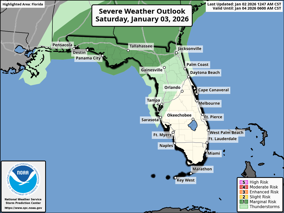
JACKSONVILLE, Florida – The National Weather Service Storm Prediction Center has issued a weather alert for North Florida and southeast Georgia on Saturday, January 3, 2026, due to a Level 1/5 (Marginal) risk of isolated strong-to-severe thunderstorms this afternoon and evening, as outlined in the SPC Day 1 Convective Outlook updated at 0600 UTC on January 2, 2026.
Thunderstorm activity is expected to develop along and north of the I-10 corridor, with potential eastward progression toward coastal southeast Georgia by Saturday afternoon and evening, driven by a weak surface cyclone and sufficient instability as noted in the NWS Jacksonville forecast discussion.
According to NWS Jacksonville, isolated thunderstorms may become strong-to-severe, particularly along the I-10 corridor and northward.
Stronger storms may produce:
North Florida and southeast Georgia areas at risk for thunderstorms include:
Saturday
Isolated strong-to-severe thunderstorms possible, with a high near 68°F as per the NWS Jacksonville zone forecast for Duval County. Chance of precipitation is 40%. Hazards include gusty winds, hail, and a slight tornado risk, especially from afternoon through evening (per NWS Jacksonville).
Saturday Night
Thunderstorms likely to taper off late, with a low around 52°F. Patchy fog may develop overnight (NWS Jacksonville zone forecast).
The NWS Jacksonville forecast indicates no significant rainfall accumulation is expected with these storms, with the primary concern being wind and hail.
Copyright 2023-2025 FloridaWord.com


