National Weather Service Storm Prediction Center Severe Weather Outlook for Florida January 25, 2026
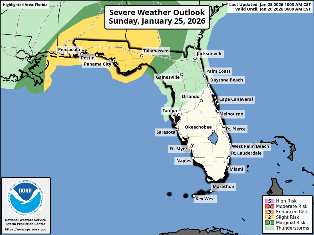
TALLAHASSEE, Florida – The National Weather Service Storm Prediction Center issued a severe weather outlook for Southeast Alabama, Southwest Georgia, the Florida Panhandle, and Big Bend due to a Slight Risk (Level 2 of 5) of strong to severe thunderstorms on Sunday, January 25, 2026.
According to the National Weather Service Tallahassee, a squall line with embedded strong thunderstorms will move across southeast Alabama and southwest Georgia from Sunday afternoon into the early evening, impacting the Florida Panhandle and Big Bend during the day.
The primary hazards are damaging wind gusts and a few tornadoes.
A Wind Advisory is in effect for areas north of a line from Panama City to Tifton, with frequent gusts of 35-45 mph possible. Secure loose outdoor items and exercise caution when driving high-profile vehicles.
The greatest chance for severe weather is across the Florida Panhandle. Cities at risk for severe weather include:
The rain and cloud coverage will bring some much needed relief to the Florida Panhandle, but it will not be enough to end the ongoing severe to extreme drought.
High temperatures across the Florida Panhandle will be in the low to mid 70s on Sunday with lows in the mid to upper 50s overnight.
Following the passage of the cold front, an arctic air mass will usher in a prolonged cold spell starting Monday morning, with hard freezes expected each night through much of the following week. The coldest temperatures are anticipated Monday night into Tuesday morning, with lows in the teens and 20s and wind chills dropping to the teens and 20s on Monday morning, becoming even colder by Tuesday. Residents should protect the 4 Ps: People, Pets, Plants, and Pipes.
Copyright 2023-2025 FloridaWord.com


