National Weather Service Storm Prediction Center Severe Weather Outlook for Florida January 25, 2026
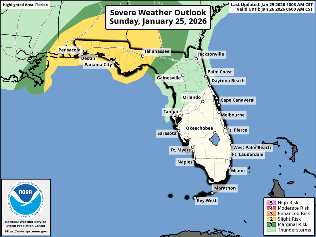
JACKSONVILLE, Florida – The National Weather Service Storm Prediction Center has issued a weather alert for North Florida and southeast Georgia on Sunday, January 25, 2026, due to a Level 1/5 (Marginal) risk of isolated strong-to-severe thunderstorms this afternoon and evening, as outlined in the SPC Day 1 Convective Outlook on January 25, 2026.
Thunderstorm activity is expected to develop along a cold front, with potential progression toward inland southeast Georgia and the Suwannee Valley in northeast Florida by Sunday afternoon and evening, driven by sufficient instability and forcing as noted in the NWS Jacksonville forecast discussion.
According to NWS Jacksonville, isolated thunderstorms may become strong-to-severe, particularly inland southeast Georgia and the Suwannee Valley.
Stronger storms may produce:
North Florida and southeast Georgia areas at risk for thunderstorms include:
Sunday
Isolated strong-to-severe thunderstorms possible late afternoon and evening, with a high near 82°F as per the NWS Jacksonville zone forecast for Duval County. Chance of precipitation is 50% tonight, but storms expected 5-11 PM. Hazards include gusty winds, small hail, and a slight tornado risk, especially from afternoon through evening (per NWS Jacksonville).
Sunday Night
Showers and thunderstorms likely to taper off late, with a low around 62°F. Beneficial rainfall expected across most areas (NWS Jacksonville).
The NWS Jacksonville forecast indicates beneficial rainfall accumulation is expected with these storms, providing needed moisture after recent dry conditions, while the primary concern remains wind and hail.
A sharp cold snap follows, with a Freeze Watch issued for Monday night, and hard freezes likely inland through the next weekend. Tuesday morning wind chills may reach 15-25°F, with Cold Weather Advisories likely. Residents are urged to protect vulnerable people, pets, plants, and pipes, wear multiple layers, and practice fire safety amid potential power outages.
Copyright 2023-2025 FloridaWord.com


