National Weather Service Florida Low Temperatures
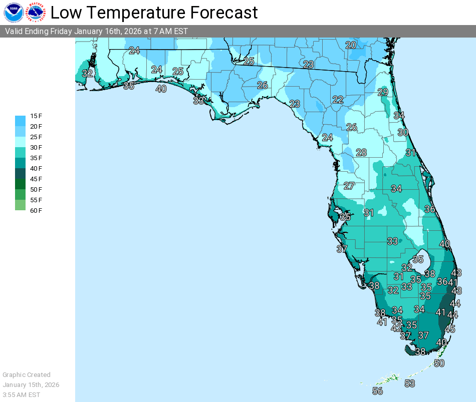
ORLANDO, Florida – A cold air mass has brought sub-freezing temperatures to east-central Florida, with freeze warnings in effect until 9 AM EST, according to the National Weather Service (NWS) in Melbourne.
Widespread lows in the 30s°F and wind chills in the 20s°F are reported across the region, including Orlando.
Freeze warnings cover inland areas such as Orange and Volusia counties, where temperatures dropped to 37°F this morning.
Residents are advised to protect sensitive plants, outdoor pipes, and vulnerable populations from the cold conditions.
Cold weather advisories extend to additional counties in east-central Florida, with wind chills making conditions feel as low as 28°F in areas like Melbourne and Daytona Beach.
The NWS Melbourne detailed the conditions in a post on X:
“A very cold start to the morning. Widespread 30s with lowest wind chills in the 20s for most. Freeze Warnings & Cold Weather Advisories remain in effect until 9AM this morning. Another cold night tonight before a brief warm-up Saturday afternoon. Next strong front Sun.”
Moderate rip current risks are present along Atlantic beaches with 2-4 foot surf.
For Orlando, the forecast includes sunny conditions today with a high near 60°F, followed by mostly clear skies tonight with lows around 44°F.
A brief warmup is expected Saturday with highs in the low 70s°F, but another strong cold front arrives Sunday, potentially bringing freezes Sunday night into Monday.
Copyright 2023-2025 FloridaWord.com

