
TAMPA BAY, Florida – The National Weather Service (NWS) Tampa Bay has issued a forecast for west Central Florida and Southwest Florida on Saturday, January 31, 2026, forecasting a cold snap with highs in the 50s to lower 60s early in the day then falling, breezy conditions, and a chance of showers. Winds will be gusty, up to 20 mph or more.
Precipitation chances are around 40-80% for showers today, diminishing tonight with a slight chance of rain/snow mix or flurries along the coast (10-20%), though accumulation is not expected.
A Small Craft Advisory remains in effect for coastal waters north of Englewood.

The forecast covers areas such as Tampa, St. Petersburg, Sarasota, and Fort Myers.

National Weather Service Tampa Radar for West Central Florida and Southwest Florida
Tampa Bay Weather Forecast
Today
Chance of showers and breezy. Mostly cloudy, with temperatures around 55°F currently, highs in the 50s to lower 60s early then falling through the afternoon. North wind 10 to 20 mph. Chance of precipitation is 40-80%.
Tonight
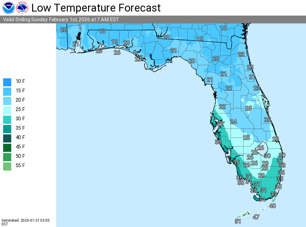
Slight chance of rain/snow or flurries, especially near the coast. Mostly cloudy, with a low around 30°F. Breezy north winds 15 to 25 mph with gusts up to 35 mph, diminishing late. Chance of precipitation is 20%.
Sunday
Mostly sunny and cold. High near 45°F. North wind around 10 mph. Chance of precipitation is 0%.
Sunday Night
Clear and cold, with a low around 28°F. Light north wind. Chance of precipitation is 0%.
Monday
Sunny, with a high near 50°F. Light and variable wind. Chance of precipitation is 0%.
Monday Night
Mostly clear, with a low around 35°F. Light east wind. Chance of precipitation is 0%.