National Weather Service Storm Prediction Center Severe Weather Outlook for Florida December 7, 2025
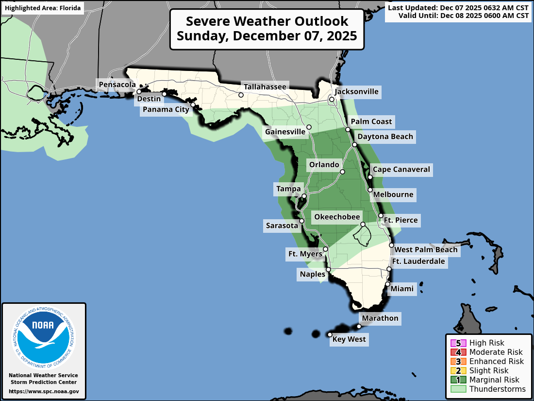
TAMPA BAY, Florida – The National Weather Service Storm Prediction Center has issued a Severe Weather Outlook for West Central Florida on Sunday, December 7, 2025, indicating a marginal risk of severe thunderstorms this evening and overnight.
Scattered thunderstorms are anticipated across the Florida Peninsula, influenced by a passing cold front moving southeastward across northern Florida.
Heavy downpours could lead to localized flash flooding over portions of Florida through mid-week.
The National Weather Service (NWS) Tampa Bay has issued a severe weather outlook for Sunday, December 7, 2025, warning of a Level 1 out of 5 risk for severe storms across the Florida Peninsula, including west central and southwest Florida.
The potential hazards include strong to damaging wind gusts (5-14% probability), isolated tornadoes (2-4% probability), and lightning throughout the evening and overnight.
The forecast covers areas such as Tampa, St. Petersburg, Sarasota, and Fort Myers.
The storms will develop over eastern Gulf waters this afternoon, moving onshore late in the day and overnight.
Copyright 2023-2025 FloridaWord.com


