National Weather Service Storm Prediction Center Severe Weather Outlook for Florida December 1, 2025
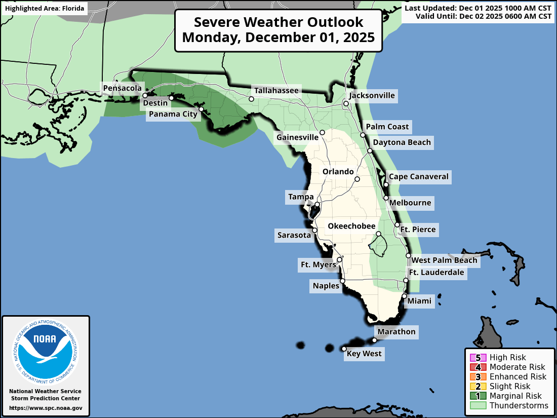
TALLAHASSEE, Florida – The National Weather Service Storm Prediction Center issued a severe weather outlook for Southeast Alabama, Southwest Georgia, and the Florida Panhandle due to a Marginal Risk (Level 1 of 5) of strong to severe thunderstorms on Monday, December 1, 2025.
According to the National Weather Service Tallahassee, a line of showers with embedded strong thunderstorms will move across southeast Alabama and southwest Georgia from late evening into early Tuesday, potentially impacting the Florida Panhandle overnight.
The primary hazards are isolated strong/severe wind gusts (40-60 mph). A brief tornado or two can’t be ruled out.
The greatest chance for severe weather is across the Florida Panhandle. Cities at risk for severe weather include:
The rain and cloud coverage will bring some much needed relief to the Florida Panhandle, but it will not be enough to end the ongoing exceptional drought.
High temperatures across the Florida Panhandle will be around 70°F on Monday with lows around 62°F overnight.
Copyright 2023-2025 FloridaWord.com


