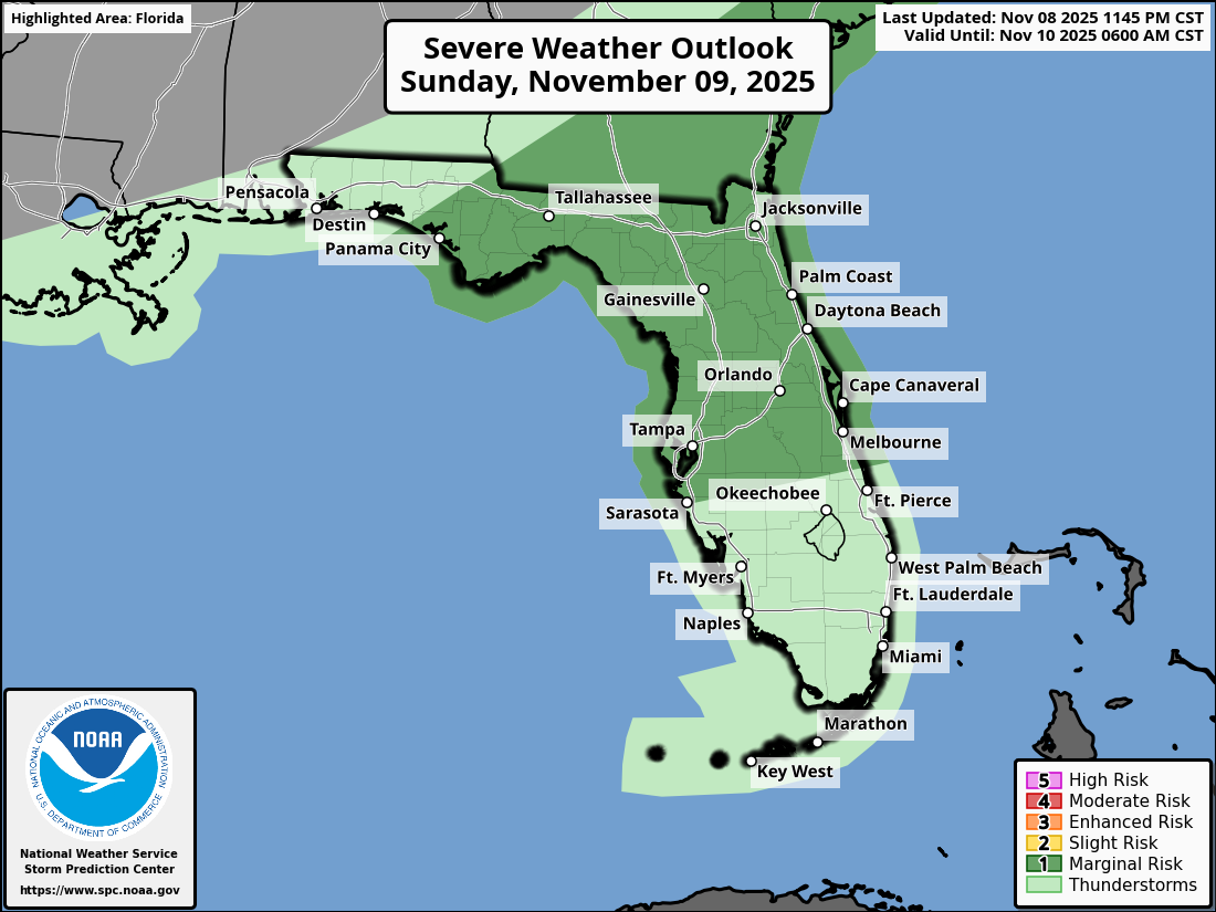
National Weather Service Storm Prediction Center Severe Weather Outlook for Florida November 9, 2025
TALLAHASSEE, Florida – The National Weather Service Storm Prediction Center issued a severe weather outlook for the Eastern Florida Panhandle, Big Bend, and south-central Georgia due to a Marginal Risk (Level 1 of 5) of strong to severe thunderstorms on Sunday, November 9, 2025.
According to the National Weather Service Tallahassee, the timing of the severe weather is expected to peak late this morning and into the afternoon hours.
Stronger storms will be capable of producing:
Florida Panhandle
and Big Bend cities at risk for severe weather are:
A potent cold front will usher in the season’s first widespread freeze Monday night, with nearly all inland areas having a 95-100% probability of temperatures below 32°F Tuesday morning. Wind chills will dip into the upper teens to lower 20s, posing risks to people, pets, plants, and pipes. There is a medium chance (40-70%) of a hard freeze (25°F or lower) across inland areas.
Elevated fire weather conditions are expected Monday and Tuesday due to low humidity (20-30% each afternoon) and gusty winds (10-20 mph with gusts up to 30 mph on Monday). This will heighten ignition risks across southeast Alabama, southwest Georgia, the Florida Panhandle, and Big Bend. Avoid open burns, keep vehicles off dry grass, and refrain from using equipment that causes sparks.
Copyright 2023-2025 FloridaWord.com


