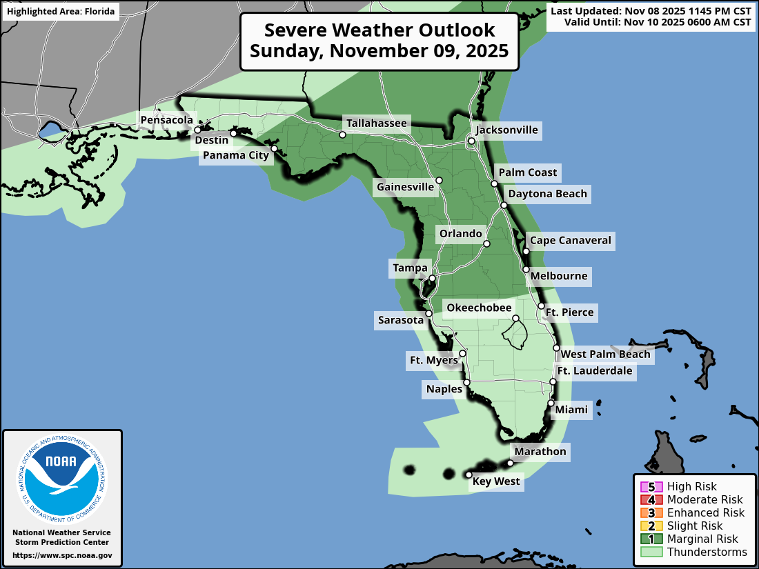
National Weather Service Storm Prediction Center Severe Weather Outlook for Florida November 9, 2025
JACKSONVILLE, Florida – The National Weather Service Storm Prediction Center has issued a severe weather outlook for North Florida on Sunday, November 9, 2025, due to a marginal risk of severe weather this afternoon and early evening.
Isolated afternoon thunderstorms are expected ahead of a strong cold front approaching the region.
According to NWS Jacksonville, isolated strong to severe thunderstorms will be possible this afternoon and early evening, over southeast Georgia and northeast Florida, mainly along and north of I-10.
Stronger storms will be capable of producing:
North Florida cities at risk for severe thunderstorms include:
Today
Cloudy, then gradually becoming mostly sunny, with a high near 85°F. West wind 6 to 10 mph, with gusts as high as 16 mph. Chance of precipitation is 20%.
Tonight
A 30 percent chance of showers and thunderstorms, mainly before 11pm, then a slight chance of showers between 11pm and 1am. Mostly cloudy, with a low around 50°F. Breezy, with a southwest wind 9 to 18 mph becoming northwest after midnight. Winds could gust as high as 28 mph.
Copyright 2023-2025 FloridaWord.com


