National Weather Service Storm Prediction Center Severe Weather Outlook for Florida November 9, 2025
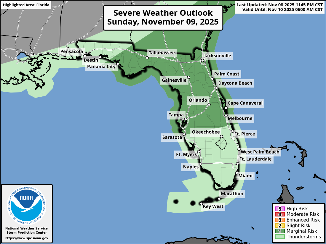
ORLANDO, Florida – The National Weather Service Storm Prediction Center has issued a Severe Weather Outlook for Central Florida on Sunday, November 9, 2025, due to a marginal risk of severe thunderstorms this afternoon and evening.
Scattered thunderstorms are anticipated across the Florida Peninsula, influenced by an approaching strong cold front producing showers and storms.
Heavy rainfall could lead to localized flash flooding over portions of Florida through mid-week.
The NWS warns of the following hazards during the peak storm hours:
According to the National Weather Service in Melbourne, the strongest storms are expected in the afternoon and evening, with a slight risk for excessive rainfall continuing through Wednesday.
Central Florida cities at risk for severe thunderstorms include:
Today
Partly sunny with showers and thunderstorms likely, mainly in the afternoon. High near 86°F. Chance of precipitation around 60%. Winds southwest around 5 to 10 mph. New rainfall amounts between a quarter and half an inch possible, with higher amounts in thunderstorms.
Tonight
Chance of showers and thunderstorms, mainly before midnight. Mostly cloudy, with a low around 59°F. Chance of precipitation around 20%. New rainfall amounts less than a tenth of an inch, except higher in thunderstorms.
Copyright 2023-2025 FloridaWord.com


