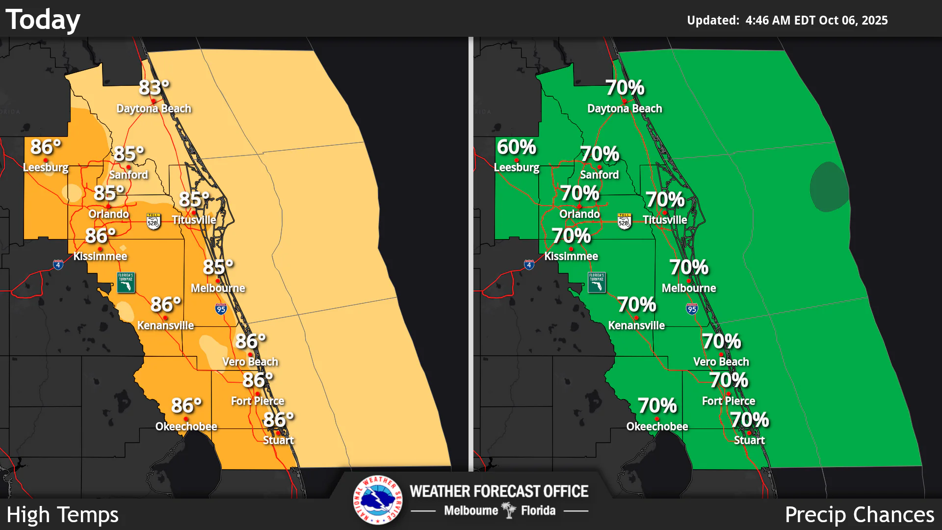
National Weather Service Melbourne High Temperatures and Rain Chances for Central Florida October 6, 2025
ORLANDO, Florida – The National Weather Service Melbourne has issued a forecast for Central Florida on Monday, October 6, 2025, of showers likely with possible thunderstorms, with a 70% chance of precipitation. Winds east 10-15 mph with gusts up to 30 mph are expected.
Showers are capable of brief downpours, locally heavy rainfall which could lead to minor flooding, especially in coastal areas during astronomical high tides caused by October’s full moon. A Flood Watch is in effect for coastal counties through this evening.
Rain chances will remain elevated through early this week, around 50-70%, while temperatures will remain near normal. A high risk of rip currents at the beaches is in effect through early this week, with large breaking waves of 5-7 ft causing rough surf and moderate beach and dune erosion.
A Small Craft Advisory is in effect for coastal waters, with east winds 15-25 knots and seas up to 10 feet offshore. Small craft should exercise caution. A High Surf Advisory is also in effect.Near normal temperatures with highs in the low to mid 80s continue, resulting in peak afternoon heat indices up to around 90-95 degrees today.
Today
Showers likely and possibly a thunderstorm. Partly sunny. High near 85°F. East wind 10 to 15 mph, with gusts as high as 30 mph. Chance of precipitation is 70%. High risk of rip currents at the beaches.
Tonight
A 30 percent chance of showers and thunderstorms. Partly cloudy. Low around 75°F. East northeast wind 10 to 15 mph, with gusts as high as 20 mph.
Tuesday
A 50 percent chance of showers and thunderstorms. Mostly sunny. High near 86°F. East wind 10 to 15 mph, with gusts as high as 25 mph.
Tuesday Night
Slight chance of thunderstorms. Partly cloudy. Low around 73°F. East northeast wind 5 to 10 mph, with gusts as high as 20 mph. Chance of precipitation is 10%.
Copyright 2023-2025 FloridaWord.com

