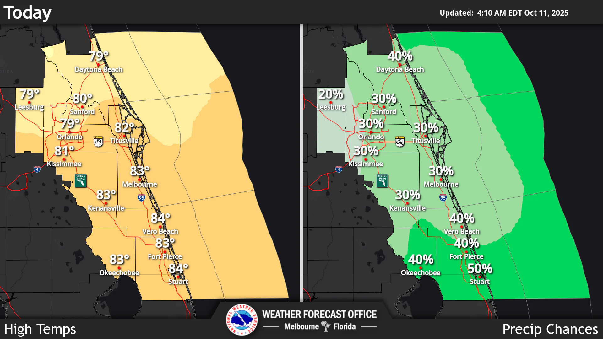
National Weather Service Melbourne High Temperatures and Rain Chances for Central Florida October 11, 2025
ORLANDO, Florida – The National Weather Service Melbourne has issued a forecast for Central Florida on Saturday, October 11, 2025, of isolated showers and storms into the afternoon, with a 30-50% chance of precipitation. Winds north to northwest 10 to 15 mph, with gusts up to 25 mph are expected, higher along the Volusia County coast.
Showers and storms are capable of occasional lightning, gusty winds up to 45 mph, and brief heavy downpours which could lead to localized minor flooding in saturated areas.
Rain chances will diminish through the weekend, below 20%, while temperatures will remain near or slightly below normal, with highs in the low to mid 80s starting Sunday.
A high risk of life-threatening rip currents at all beaches is in effect, with a High Surf Advisory for Volusia County through late tonight causing rough surf of 4-8 ft and moderate beach erosion. Small craft advisory in effect for hazardous boating conditions, with seas 6 to 10 ft, winds 15-25 kt.
Below normal temperatures with highs in the upper 70s to low 80s continue today, with lows in the low to mid 60s.
Today
Partly sunny, with a chance of showers and thunderstorms, mainly after 2pm. High near 79°F. North wind 10 to 15 mph, with gusts as high as 20 mph. Chance of precipitation is 30%. High risk of rip currents at the beaches.
Tonight
Mostly cloudy, with a slight chance of showers and thunderstorms before 8pm. Low around 65°F. North northwest wind around 10 mph, with gusts as high as 20 mph. Chance of precipitation is 10%.
Sunday
Mostly sunny. High near 81°F. Northwest wind around 10 mph.
Sunday Night
Mostly clear. Low around 65°F. North wind around 5 mph.
Copyright 2023-2025 FloridaWord.com


