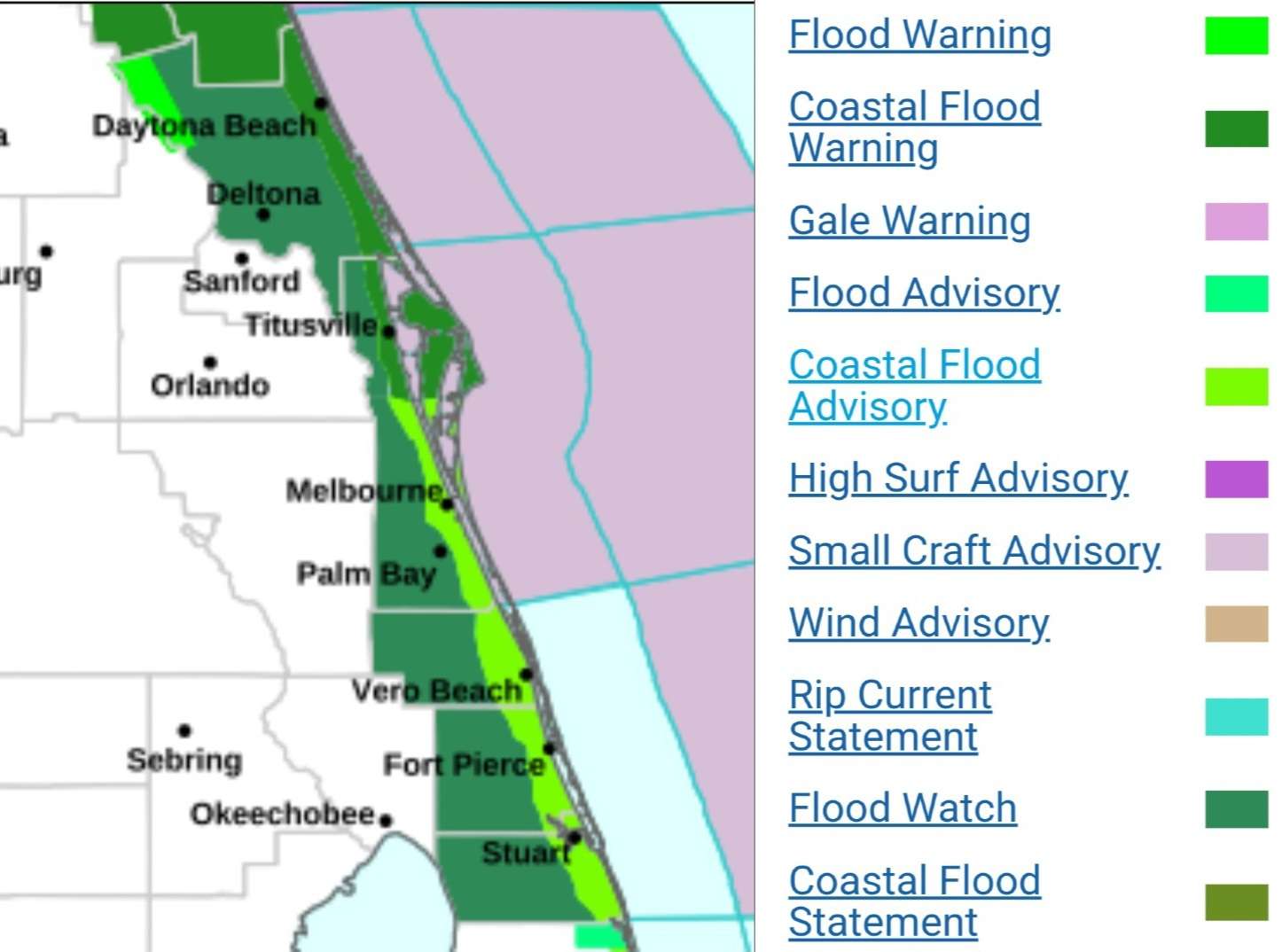
Map of Current Weather Alerts in East Central Florida. Credit: National Weather Service (NWS).
DAYTONA BEACH, Florida – Residents along Central Florida‘s east coast should brace for persistent flooding, dangerous rip currents, and hazardous marine conditions due to heavy rainfall, northeast winds, and elevated tides, according to the National Weather Service.
Significant inundation of homes, businesses, infrastructure, road closures, and shoreline erosion is expected. Minor coastal flooding continues under advisories extended to early Friday.
The St. Johns River near Astor is in moderate flood stage at 3.1 feet (flood stage: 2.3 feet), projected to rise to 3.4 feet by early next week. Low-lying homes, roads, and campgrounds, including Wildhog Road, Alligator Road, and McPherson Lane, face flooding risks.
A Flood Watch covers Volusia, Brevard, Indian River, St. Lucie, and Martin counties through Friday evening. Excessive runoff may flood rivers, creeks, and urban areas. Scattered thunderstorms could worsen conditions.
Avoid flooded roads (“Turn around, don’t drown”), secure property, monitor tides and barricades. Swimmers should stay out of the water, and boaters should remain in port. Stay updated with NWS alerts.
Copyright 2023-2025 FloridaWord.com
