NOAA National Hurricane Center Tropical Weather Outlook for September 6, 2025.
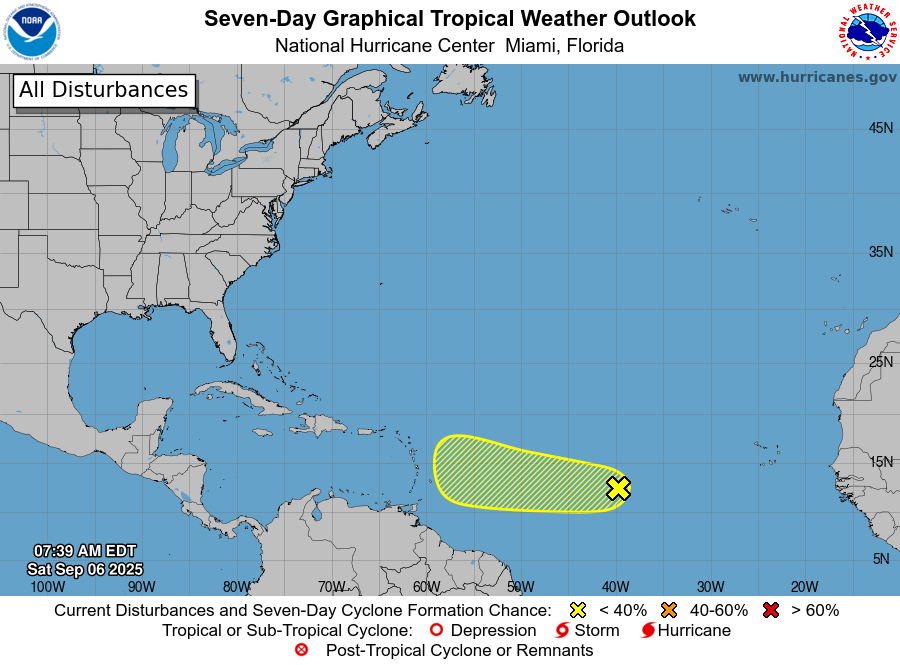
MIAMI, Florida – NOAA‘s National Hurricane Center in Miami, Florida, issued a Tropical Weather Outlook at 8 a.m. Eastern Daylight Time on Saturday, September 6, 2025, due to the presence of Invest 91L located over the eastern tropical Atlantic.
If Invest 91L develops into a tropical storm or hurricane, the next name on the 2025 Atlantic Hurricane List is Gabrielle.
Invest 91L is a tropical wave over the central tropical Atlantic that is producing a small area of disorganized showers and thunderstorms (marked with a yellow shaded area).
NHC forecasters say that environmental conditions are only marginally conducive for development, and the chances of this system becoming a tropical depression are decreasing.
The wave is expected to move generally westward at 10 to 15 mph, and will likely be near the Lesser Antilles by the middle part of next week. Interests there should monitor its progress.
This system has a 30% chance of tropical cyclone formation within the next 7 days and a 30% chance within the next 48 hours.
Computer models, often referred to as spaghetti models, are in general agreement during the first 48 hours that the system will move west-northwestward across the tropical Atlantic.
After 48 hours, the models continue to show significant divergence, with about half indicating no development and the other half suggesting some potential. The spaghetti models display a wide spread in paths, from impacts near the Virgin Islands to veering well north. Stronger systems tend to curve northwest earlier, while weaker ones continue westward over the Caribbean or further. Recent runs indicate even less overall support for development, with forward speed having slowed down further. Environmental dry and dusty air is impacting the system, adding to the uncertainty.
The European model and its AI variant have consistently shown no development in recent runs, potentially fizzling the system in the central Atlantic without major impacts. In contrast, the GFS (American model) and CMC continue to forecast development into a tropical depression or storm, possibly Gabrielle, by the weekend, with potential effects on the Bahamas around September 15th and a close approach to the U.S. East Coast near the Carolinas and Virginia later in the month. Intensity models vary widely, but some suggest it could reach hurricane strength if it organizes. Overnight models show little development, and ensembles suggest possible new waves off Africa and random ideas in the Gulf, but nothing solid on main operational models. Overall, the path and intensity remain highly uncertain due to model divergence, and it is too early to determine specific impacts to Florida or other U.S. areas.
NOAA forecasts an “above-normal” 2025 Atlantic Hurricane Season, which runs from June 1 through November 30.
Peak hurricane season is September 10 according to NOAA and the National Weather Service‘s historical hurricane activity data.
Copyright 2023-2025 FloridaWord.com


