National Weather Service Central Florida rain chances and low temperatures September 13, 2025
ORLANDO, Florida – The National Weather Service Melbourne has issued a forecast for Central Florida on Saturday, September 13, 2025, of scattered showers and isolated to scattered thunderstorms, mainly in the afternoon into early evening, with a 40% chance of precipitation in Orlando and higher coverage (50-60%) south of the I-4 corridor. Breezy northeast winds of 10-15 mph are expected, with gusts up to 25 mph.
Thunderstorms are capable of occasional lightning, gusty winds, small hail, and heavy rainfall which could lead to minor flooding, especially along the Treasure Coast.
Rain chances will remain around 40-60% through the weekend south of the I-4 corridor, while temperatures will remain near normal. A high risk of rip currents at the beaches is in effect today, with entering the surf not advised due to rough surf of around 3-5 feet and hazardous boating conditions. Small craft advisory in effect for northern waters, with seas 5 to 7 feet, up to 6 feet offshore. Flooding remains a concern with any heavy downpours.
Near normal temperatures with highs in the mid 80s continue, resulting in peak afternoon heat indices up to around 92-95 degrees today.
Today
A chance of showers and thunderstorms after 1pm. Mostly sunny. High near 86°F. North northeast wind 10 to 15 mph, with gusts as high as 25 mph. Chance of precipitation is 40%. High risk of rip currents at the beaches.
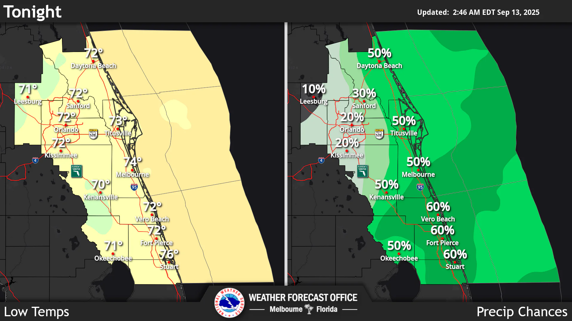
Tonight
A chance of showers and thunderstorms before 9pm. Mostly clear. Low around 71°F. North wind 5 to 10 mph, with gusts as high as 20 mph. Chance of precipitation is 20%.
Sunday
A chance of showers and thunderstorms after 2pm. Sunny. High near 86°F. North northeast wind 5 to 10 mph. Chance of precipitation is 40%.
Sunday Night
A chance of showers and thunderstorms before 8pm. Mostly clear. Low around 71°F. North northeast wind 5 to 10 mph. Chance of precipitation is 30%.
Copyright 2023-2025 FloridaWord.com


