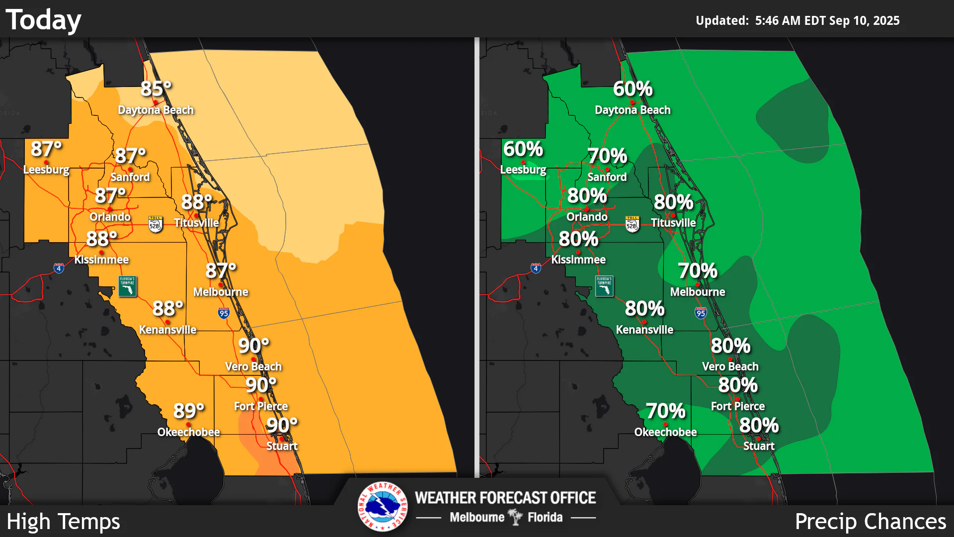
National Weather Service Central Florida rain chances and high temperatures September 10, 2025
ORLANDO, Florida – The National Weather Service Melbourne has issued a forecast for Central Florida on Wednesday, September 10, 2025, of high coverage of showers and storms (60-80%), with a Marginal Risk of excessive rainfall across the area. Winds north 5 to 10 mph are expected.
Thunderstorms are capable of occasional lightning, gusty winds, and heavy rainfall which could lead to minor flooding.
Rain chances will remain elevated through the week, decreasing to around 50% on Thursday and 40% by Friday, while temperatures will remain near normal. A high risk of rip currents at the beaches is in effect today.
Near normal temperatures with highs in the mid to upper 80s continue.
Today
Showers and thunderstorms likely, mainly after 5pm. Partly sunny. High near 87°F. Winds north 5 to 10 mph. Chance of precipitation is 80%. High risk of rip currents at the beaches.
Tonight
Showers and thunderstorms likely, mainly before 1am. Mostly cloudy. Low around 74°F. Winds north northeast 5 to 10 mph. Chance of precipitation is 60%.
Thursday
A chance of showers, then a chance of showers and thunderstorms after 11am. Partly sunny. High near 86°F. Winds north northeast 5 to 10 mph. Chance of precipitation is 50%.
Thursday Night
A slight chance of showers and thunderstorms. Mostly cloudy. Low around 73°F. Winds north northeast 5 to 10 mph. Chance of precipitation is 20%.
Copyright 2023-2025 FloridaWord.com


