National Weather Service Storm Prediction Center Severe Weather Outlook for Florida Saturday, August 2, 2025.
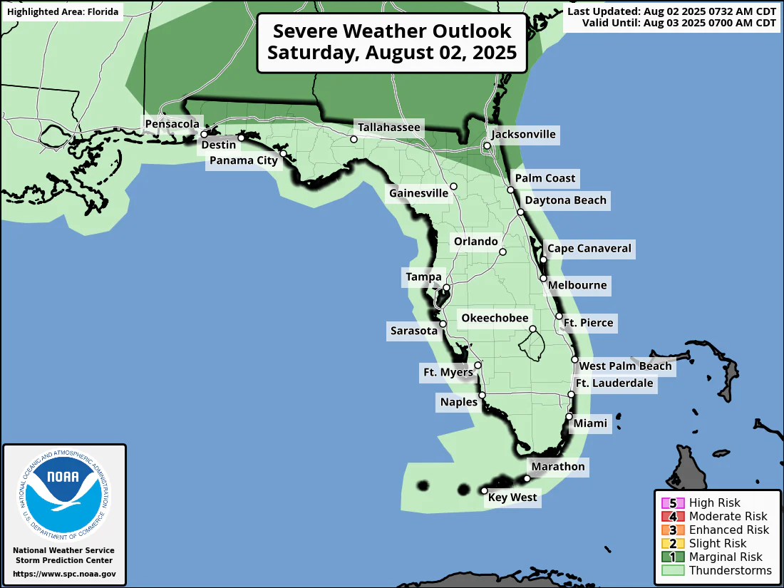
JACKSONVILLE, Florida – The National Weather Service in Jacksonville has issued a forecast for North Florida predicting strong to marginally severe thunderstorms on Saturday, August 2, 2025.
According to NWS Jacksonville, thunderstorm coverage will increase this afternoon and evening, with strong to marginally severe thunderstorms possible mainly along and north of the I-10 corridor.
Stronger storms along and north of the I-10 corridor will be capable of producing:
North Florida cities at risk for strong thunderstorms include inland and coastal regions, with specific cities in the shaded area such as:
Additionally, several waves of thunderstorms will develop along a slowing front as it reaches southern Georgia and moves near the Florida-Georgia state line over the weekend.
An abundance of moisture and energy will lead to heavy rain and potentially 3-5 inches of rain with locally higher amounts up to 6 inches. This may lead to flooding, especially in flood prone urban areas such as Jacksonville.
Today
Showers and thunderstorms, mainly after 2pm. High near 92. Heat index values as high as 103. West wind around 8 mph. Chance of precipitation is 80%. New rainfall amounts between a tenth and quarter of an inch, except higher amounts possible in thunderstorms.
Tonight
Showers and thunderstorms, mainly before 1am, with some storms possibly producing heavy rainfall. Low around 78. East wind 5 to 7 mph becoming calm after midnight. Chance of precipitation is 80%. New rainfall amounts between a tenth and quarter of an inch, except higher amounts possible in thunderstorms.
Sunday
Showers and thunderstorms, mainly after 2pm. High near 90. Heat index values as high as 100. West wind 3 to 7 mph. Chance of precipitation is 90%. New rainfall amounts between a quarter and half of an inch possible.
Sunday Night
Showers and thunderstorms, mainly before 8pm, with some storms possibly producing heavy rainfall. Low around 75. East wind around 6 mph becoming calm in the evening. Chance of precipitation is 80%.
Copyright 2023-2025 FloridaWord.com


