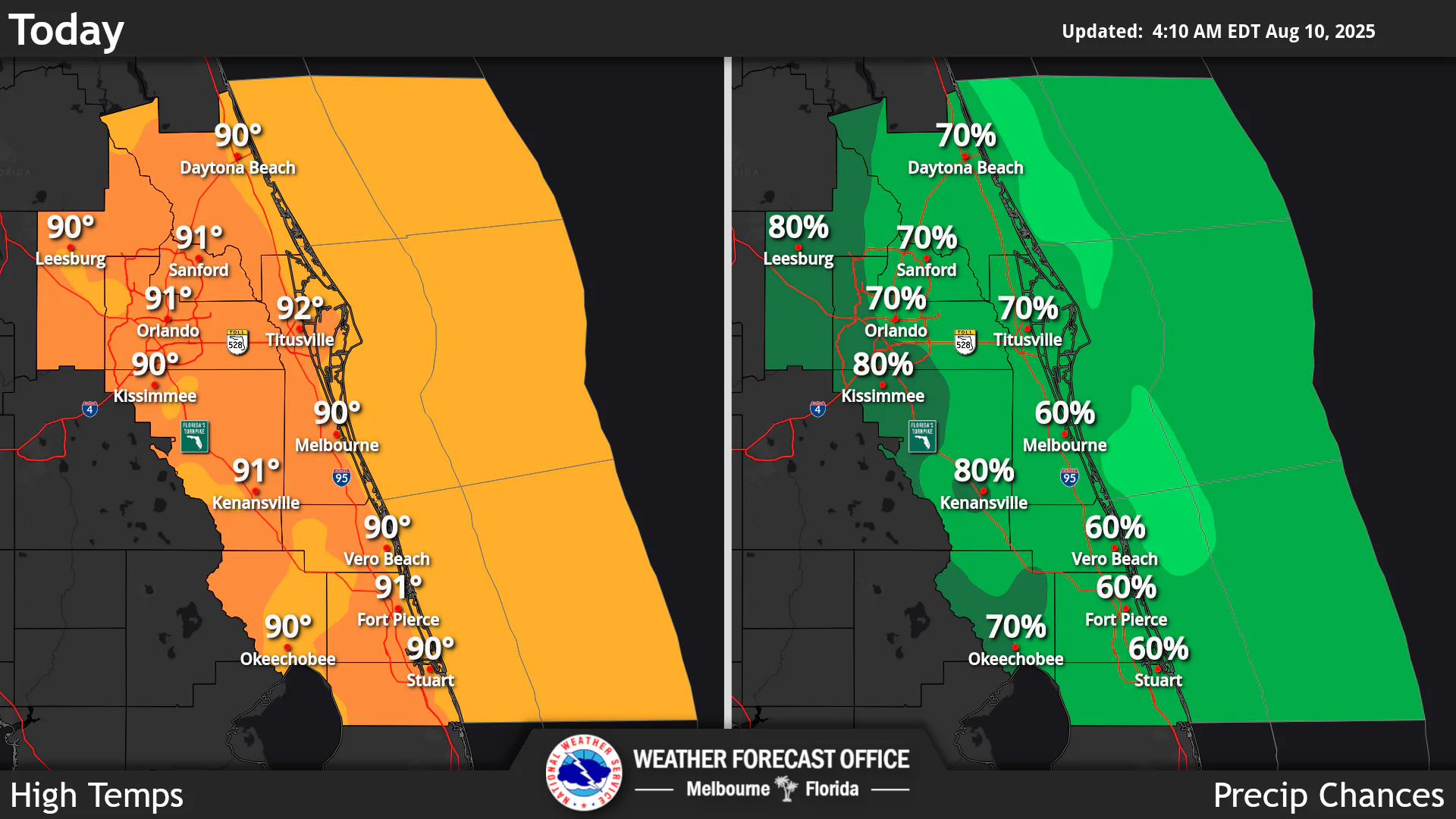
National Weather Service Central Florida rain chances and high temperatures.
ORLANDO, Florida – The National Weather Service Melbourne has issued a forecast for Central Florida on Sunday, August 10, 2025, of high rain chances around 70-80% across the interior and 60-70% along the coast, with afternoon and evening showers and lightning storms favoring the interior.
Stronger storms will be capable of frequent lightning, gusty winds of 40 to 50 mph, and heavy rainfall which could lead to minor flooding.
Near normal temperatures with highs in the low 90s continue, resulting in peak afternoon heat indices up to 105 degrees.
An unsettled weather pattern will lead to high rain chances through the weekend (70-80%), with locally heavy rainfall and minor flooding concerns each day. Rain chances will begin to decrease slightly into the early to middle portion of next week, but remain near normal, while temperatures will rise to above normal values. A high risk of rip currents at the beaches is expected today. Two disturbances are being monitored across the Atlantic Basin.
Today
A slight chance of showers, then showers and thunderstorms likely after 11am. High near 92°F. Chance of precipitation around 70%. South southeast wind 5 to 10 mph. Peak heat indices up to 105°F. High risk of rip currents at the beaches.
Tonight
Showers and thunderstorms likely before 11pm, then a slight chance of showers between 11pm and 1am. Mostly cloudy, with a low around 75°F. Chance of precipitation around 60%.
Monday
Showers and thunderstorms likely after 2pm. High near 93°F. South southeast wind 5 to 10 mph. Chance of precipitation is 60%.
Monday Night
Showers and thunderstorms likely before 11pm, then a slight chance of showers between 11pm and 2am. Low around 76°F. Southeast wind around 5 mph. Chance of precipitation is 60%.
Copyright 2023-2025 FloridaWord.com


